
Photo by Dave Hoefler on Unsplash
The Origin of the Badlands, South Dakota
The Badlands canyons and cliffs are beautiful. What is the real history behind the rock layers and fossils found there, and what can we learn along the way?
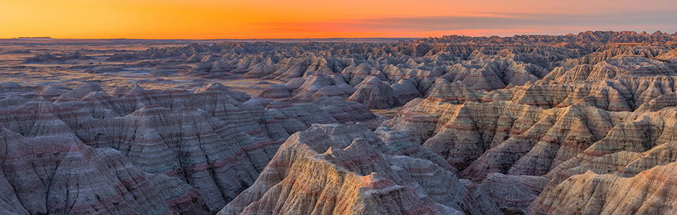
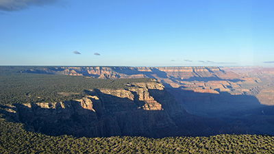
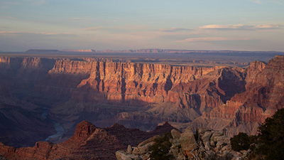
The eroded cliffs of the Badlands terrain of west central South Dakota with their variously colored layers are beautiful and desolate, fascinating yet formidable (Fig. 1). Early settlers avoided this land because it was poor for farming and was a barrier to travel.
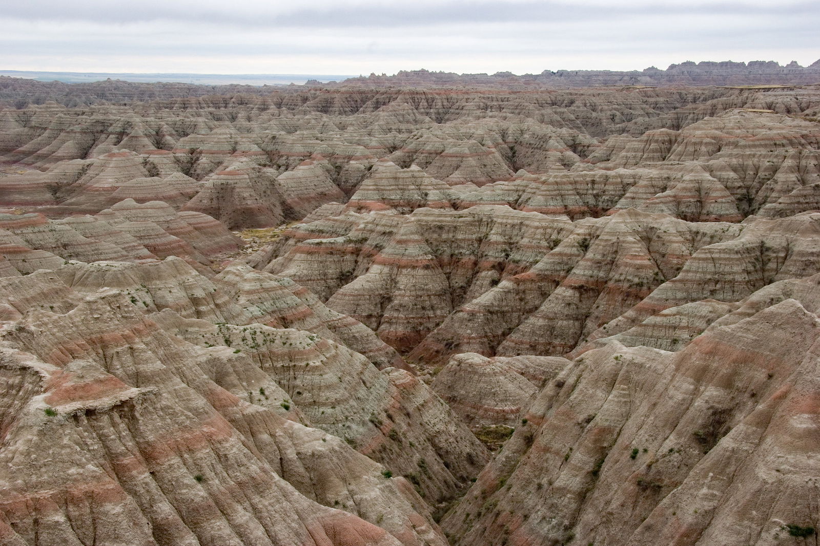
Fig. 1. The variegated colors of the sedimentary layers as exposed in the eroded barren landscape of the Badlands National Park, west central South Dakota. This image was published by Kimon Berlin via Flickr under the Creative Commons Attribution-Share Alike 2.0 Generic license.
Yet from the walls of the canyons and cliffs of this hostile terrain and from along stream banks have come the strange bones of probably the richest storehouse of vertebrate fossils in all of North America. It provides much of what we know about North America’s “Golden Age of Mammals” in the so-called Oligocene Epoch, supposedly 23–34 million years ago. From 1899 to today, the South Dakota School of Mines has sent people almost every year to dig for fossils and remains one of the most active research institutions working in the Badlands.
Because private collectors and amateurs were indiscriminately pilfering this fossil treasure trove, the US Congress authorized protection of the area as the Badlands National Monument (Lakota: Makȟóšiča) on March 4, 1929, but it was not established until January 25, 1939. On November 10, 1978, the Badlands were redesignated as a national park. As the Wikipedia page notes, “The park protects 242,756 acres (379.3 sq mi; 982.4 km2) of sharply eroded buttes and pinnacles, along with the largest undisturbed mixed grass prairie in the United States.”1
Today, a 28-mile (45 km) scenic highway with numerous overlooks winds through the northern section of the park. The best times to take this drive are early in the morning and late in the afternoon. Then the sun’s rays slant into the deep gorges and gullies and light up the hues of pink, yellow, green, maroon, cream, gray, and red on the spires and pinnacles (Fig. 1). Buttresses and cliffs stand out in relief.
This colorful rugged desolation has important lessons to teach us as we explore how it was formed. However, we need to view the Badlands though the correct lens of history if we are to discover these important lessons.
The “Story” of Layers and Fossils
At the base of the sediment layers exposed in the Badlands is the 1,200 feet (365 meters) thick Pierre Shale (Fig. 2). It stretches from the Gulf of Mexico (now Gulf of America) northward into Canada and contains the fossilized skeletal remains of marine animals such as mosasaurs and plesiosaurs (large marine reptiles), fish, turtles, crabs, bivalves (clams), ammonites, and starfish, and land animals such as dinosaurs and pterosaurs. In the conventional time frame, its deposition occurred slowly in the so-called Late Cretaceous Period, from 65 to 80 million years ago.
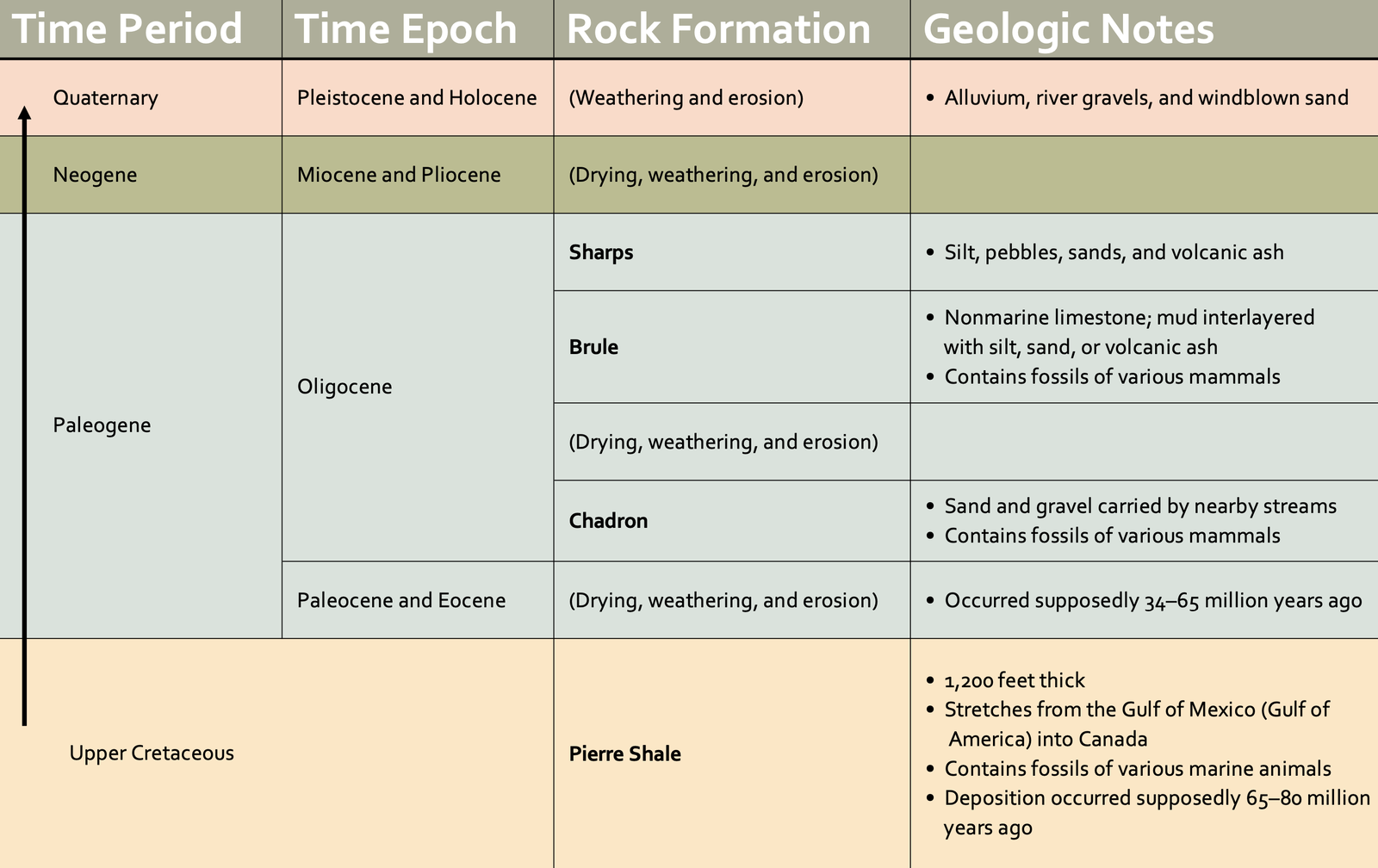
Fig. 2. Details of the strata found in the Badlands National Park and surrounding areas. The standard conventional geologic time units of periods and epochs are shown on the left, while to the right is the conventional (slow-and-gradual over millions of years) interpretation of the supposed geologic events and environments represented by the sediments, weathering, and erosion during those designated time units.2
After the waters slowly and fully retreated, the exposed ground surface dried out and was weathered during the supposed Paleocene and Eocene Epochs some 34–65 million years ago. Meanwhile, the nearby Black Hills were being slowly domed upward, eventually reaching their maximum elevation. This resulted in severe erosion as rivers drained from those mountains and slowly carved a rolling terrain of hills and valleys. Those streams dumped their loads of sand and gravel across the eroded surface of the Badlands area in what is known as the Chadron Formation (Fig. 2). Buried in the Chadron Formation are the fossil bones of titanotheres (extinct rhinoceroses), horses (Fig. 3), and tapirs, as well as of other mammals.
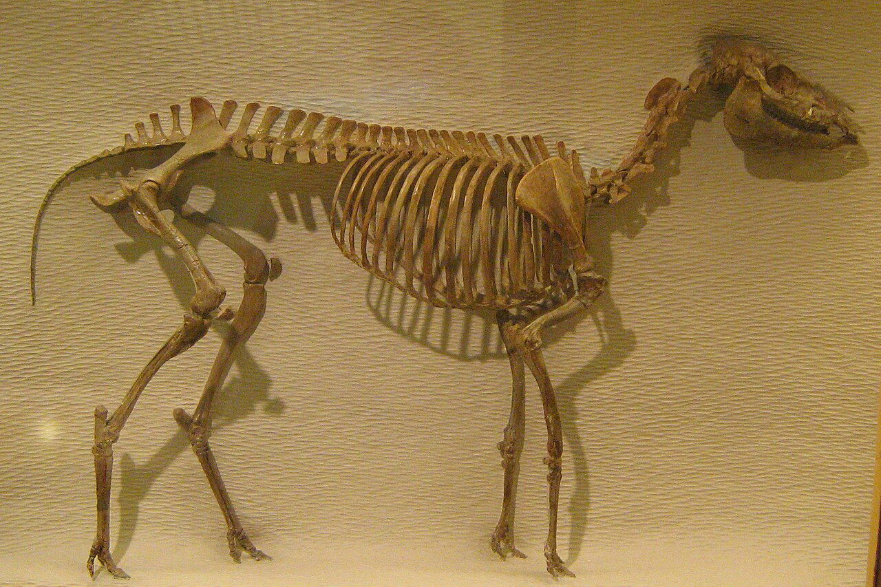
Fig. 3. Picture of a reconstructed fossil of Mesohippus barbouri at the Harvard Museum of Natural History. This image was published by David Starner via Wikimedia Commons under the Creative Commons Attribution 3.0 Unported license.
There was further drying and weathering before the deposition of a thin sheet of nonmarine limestone occurred across the area followed by thick sheets of muds interlayered with thin beds of silt, sand, or volcanic ash in what is called the Brule Formation (Fig. 2). Within these sediments are the fossilized remains of more titanotheres and extinct mammals related to camels, pigs, rodents, saber-toothed cats, turtles, and dogs.
The topmost layers in the Badlands are the Sharps Formation, consisting of poorly consolidated beds of silt, pebbles, and sands, as well as large amounts of volcanic ash (Fig. 2). Some of the ridge tops in the Badlands are capped with resistant sandstone beds, underneath which is a layer of nearly pure, white volcanic ash.
According to this “story,” all these Chadron, Brule, and Sharps layers were deposited with their contained fossils during the so-called Oligocene Epoch spanning 23–34 million years ago. Then for the next 22 million years or so, there was little erosion or deposition.
Toward the end of the Pleistocene ice age about half a million years ago, the deep erosion of the Badlands began. While not covered by the continental glaciers, the Badlands were close to the glacial margins. So streams of melted water eroded their way across the Badlands, slowly carving out today’s topography of complex, intricately dissected steep slopes and sharp ridges exposing the colorful, laminated, poorly consolidated sediment layers. It is estimated that the rate of erosion was similar to today’s erosion rate of about one inch (25.4 mm) per year.3
Today’s arid landscape is dominated by the swelling clays of the weathered volcanic ash in the exposed sediment layers and by the variegated colors due to the varying amounts of contained iron and other oxides. The barrenness is due to the lack of nutrients in the ubiquitous volcanic ash in the many layers that does not support more than stunted vegetation.
What Really Happened
The above “story” was constructed by geologists who never witnessed those millions of years. On the other hand, God was the eyewitness of all of earth’s history. He created it only about 6,000 years ago and then judged it by the global Flood cataclysm about 4,300 years ago. Thus, the biblical account of earth history in Genesis He provided helps us make sense of these sediment layers and their contained fossils now exposed in the Badlands.
The Pierre Shale sits on top of a thick stack of thin sediment layers (like pancakes) containing many marine fossils that cover much of the North American continent.4 Therefore, these continent-covering “pancake” layers with their marine fossils must represent the “billions of dead things buried in rock layers laid down by water all around the globe.” The waters of the global Flood cataclysm had catastrophically swept across the continent, carrying countless marine creatures and loaded with sediments, including lime sands, silts, and muds. So the thick stack of thin layers was all likely deposited within the first 150 days of the Flood, not over hundreds of millions of years.
So the thick stack of thin layers was all likely deposited within the first 150 days of the Flood, not over hundreds of millions of years.
However, after deposition of the Pierre Shale almost halfway through the Flood year, the floodwaters retreated progressively and gradually, and the new land surfaces began drying out. Rising mountains helped the floodwaters to retreat. Psalm 104:8 describes the mountains rising and the valleys forming during the recessional phase of the Flood so that the waters drained off the earth into today’s new ocean basins.
This intense drying out phase marked the second half of the Flood year. God was preparing the new post-Flood land surface for Noah, his family, and his animal cargo to soon live on.
It is significant that the fossils found subsequently deposited in the thin sediment and volcanic ash layers in the Badlands are nearly all land mammals, including the ancestors of today’s horses, rhinos, and camels. Thus, those mammals would seem to be the descendants of the mammals that alighted from the ark, having migrated from the mountains of Ararat to North America in the early decades after the Flood.
Therefore, the “Oligocene” Chardon, Brule, and Sharps Formations are all post-Flood sediment layers deposited over only a few decades locally in the Badlands area as a result of the erosion of the nearby rapidly uplifted Black Hills mountains. Mammals living in the area were buried in rapid deposition events due to the volatile early post-Flood climate when the warmer oceans spawned frequent heavy rainfall storms.
To the north, the same storms were dumping heavy snowfall across inland Arctic Canada and Alaska. The volcanic activity that deposited ash in the post-Flood sediment layers in the Badlands area also ejected volcanic dust high into the atmosphere. That dust blocked sunlight so that the summers were cooler. Thus, in the Arctic north, the thickly accumulating snow did not melt but instead compacted over the ensuing decades to form the continental ice sheets and glaciers of the post-Flood ice age.
After several hundred years, the ocean waters cooled, and the storms decreased in frequency and intensity. Volcanic activity declined, and the atmospheric dust cleared. With decreased snowfall and warmer summers, the ice sheet and glaciers began to rapidly melt. Raging streams of meltwater flowed southward across the Badlands area, deeply eroding into the poorly consolidated, post-Flood sediment layers and carving out rapidly today’s topography of complex, intricately dissected steep slopes and sharp ridges, buttes, and pinnacles within a few decades.
When the ice had fully melted and the streams subsided to trickles, the landscape dried out under the warming post-ice-age climate. Hotter and drier summers meant more intense weathering over the next few decades. In the exposed sediment layers of the Badlands area, the volcanic ash swelled. And the extreme weathering interacted with the iron and other oxides to produce the intense variegated colors that now bejewel the thin layers in the steep slopes.
However, even though the climate here is now very dry and the landscape is considered barren, occasional thunderstorms with heavy rainfall still occur. Consequently, the runoff from the barren landscape, with the poorly consolidated sediment layers unprotected by vegetation, has been measured to erode the normally dry gullies by as much as an inch per year (25.4 mm). Therefore, even at today’s slower rates, the erosion of the Badlands cannot have been happening for half a million years! The topography of the Badlands thus formed in just the last few thousand years, consistent with God’s account of earth history.
Important Lessons
It is crucial we learn several important lessons.
First, in a court of law, the testimony of an eyewitness always trumps the inferences made by the forensic scientists who did not see the crime happen. God sees and knows everything and never lies (Titus 1:2), so His written testimony in His Word must be our guide in understanding the earth’s history.
Second, God tells us He sent the global Flood cataclysm as the judgment of a violent rebellious humanity, only about 4,300 years ago. God hates sin! It necessitated complete destruction of the earth because all flesh had corrupted the earth (Genesis 6:13). God caused the ocean waters to rise rapidly and catastrophically wipe away all land life as the waters swept across the pre-Flood land.
Third, however, even in judgment, God was merciful. At God’s instruction, Noah and his family, along with the representatives of every kind of land animal and bird that God sent to Noah, were aboard the ark that safely rode out the Flood. After the Flood, Noah, his family, and those land animals and birds repopulated the new land surface, migrating across the globe.
Fourth, God promised Noah and his descendants that in the post-Flood world there would be climate stability with summer and winter, seedtime and harvest never ceasing (Genesis 8:22). The post-Flood weather patterns were initially turbulent, resulting in the rapid shaping of the earth’s new landscape. Nevertheless, God’s promise still stands, so we need not fear that today’s occasional severe weather events or changing climate will put an end to the God-ordained seasons.
God’s wrath is thus satisfied, and our sin is forgiven if we repent and trust in Christ as Savior and Lord.
And finally, just as God saved Noah, his family, and the land animals and birds from destruction in a vessel of safety, He has provided for us the way of salvation from the final judgment soon to come by fire (2 Peter 3:7, 10). Jesus Christ, God’s son and our Creator, came to earth as a man to die, suffering God’s judgment that we all deserve. He paid the penalty for our sin. God’s wrath is thus satisfied, and our sin is forgiven if we repent and trust in Christ as Savior and Lord. Yet Jesus also conquered death by His resurrection. He can thus offer us eternal life with Him in the glory of His Father’s heavenly home. But as Noah had to trust God and accept His salvation offer by going aboard the ark, we must accept God’s salvation offer through Jesus.
So the Badlands are a testimony to the destruction of the earth and animal life. Yet their rugged, colorful beauty reminds us of God’s sovereign control over all things and of His love and mercy toward us when we place our trust in Him, both for now and for eternity.
Footnotes
- Wikipedia, “Badlands National Park,” last edited February 19, 2026, https://en.wikipedia.org/wiki/Badlands_National_Park.
- Philip W. Stoffer, Geology of Badlands National Park: A Preliminary Report (U.S. Geological Survey, 2003), Open-File Report 03-35; Ann G. Harris, Esther Tuttle, and Sherwood D. Tuttle, Geology of the National Parks, 6th ed. (Dubuque, IA: Kendal/Hunt Publishing Co., 2004), 115–128.
- National Park Service, “Geologic Formations: How Badlands Buttes Came to Be,” accessed February 2026, https://www.nps.gov/articles/000/badl-geologic-formations.htm.
- F. Alan Lindberg, ed., Correlation of Stratigraphic Units of North America (Tulsa, OK: American Association of Petroleum Geologists, 1988); Timothy L. Clarey, Carved in Stone: Geologic Evidence of the Worldwide Flood (Dallas, TX: Institute for Creation Research, 2020), https://store.icr.org/carved-in-stone.html.


Support the creation/gospel message by donating or getting involved!

Answers in Genesis is an apologetics ministry, dedicated to helping Christians defend their faith and proclaim the good news of Jesus Christ.
- Customer Service 800.778.3390
- Available Monday–Friday | 9 AM–5 PM ET
- © 2026 Answers in Genesis