
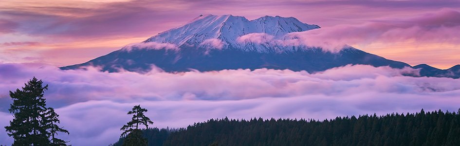
Four Lessons from the Mount St. Helens Eruption
The eruption of Mount St. Helens 40 years ago today still provides an amazing opportunity for scientists to study the effects of a catastrophe.
The event on May 18, 1980, is often regarded as one of the most significant geologic events of the twentieth century. The incredible lessons are as valuable as ever!
Geologists, who are accustomed to thinking about slow evolutionary processes shaping our world, were astounded by the scale of initial destruction and the speed at which new geologic features formed. Forty years later, Mount St. Helens still teaches us lessons about the powerful forces the Creator uses to shape the earth. These findings confront the underlying slow-and-gradual assumptions of modern geologic thinking, and they give us invaluable clues about the catastrophic potential and consequences of a global, cataclysmic flood.
Mount St. Helens still teaches us lessons about the powerful forces the Creator uses to shape the earth.
Yet as young-earth creationists emphasize the evidences at Mount St. Helens as relevant to understanding the earth’s past, old-earth skeptics continue to raise strenuous objections. For these skeptics’ slow-and-gradual thinking is a dogma that simply cannot be challenged lest the Bible be right about the global flood cataclysm. That, of course, would mean there is a Creator God to whom we are all accountable!
So, what happened, what lessons did we learn, and how do we counter the skeptics’ objections to them?
Forty years ago, at 8.32 am May 18, 1980, Mount St. Helens in Washington state erupted with an initial blast of steam—equivalent to 20 megatons of TNT.1 The whole northern side of the once pristine cone-shaped volcano (two-thirds of a cubic mile of rock) slid away—the largest observed landslide on record. Within a few minutes an area of about 230 square miles (600 sq. km) was devastated. The total energy output during the subsequent nine-hour eruption was equivalent to 440 million tons of TNT or approximately 33,000 Hiroshima atomic bombs.2 That’s about one such atomic bomb exploding every second for nine hours! But that eruption was followed by several more eruptions over the next six years.
Lesson One
The volcanic blast of May 18, 1980, traveling at an initial speed of over 650 miles per hour (300 m/sec.), destroyed the forests in at least the surrounding 150 square miles (390 sq. km) within six minutes!2,3,4,5 Douglas firs as tall as 200 feet (61 m) were instantly stripped of their branches and snapped like toothpicks.
As the side of the volcano slid into the nearby Spirit Lake, it pushed a wave of water from the lake into the nearby forest, dragging many logs back into the lake as the surge returned. By late afternoon over one million logs were floating on the lake. Many were floating upright. Even though the roots were broken off, the bases were still thicker and denser, causing the logs to float this way.
Many logs subsequently sank to the floor of the lake, still upright but rootless. Indeed, it was estimated that about 20,000 upright, fully submerged logs were sitting on the floor of the lake by August 1985. They looked like a forest of trees buried in mud. Radar and scuba divers found that many logs had become buried by more than 3 feet (1 m) of sediment, while others were still resting on the floor of the lake.6,7
Within these five years the enormous log mat floating on Spirit Lake lost its bark and branches, rubbed off by the abrasive action of wind and waves. Scuba investigations of the lake bottom subsequently revealed that sheets of bark intermingled with volcanic sediments had formed a layer of peat more than 3 feet (1 m) thick. Together with broken branches and root materials, the sheets of bark gave the peat a coarse texture and a layered appearance. This “Spirit Lake peat” which accumulated in just five years resembles, both compositionally and texturally, certain coal beds of the eastern United States.2,3,4,5
Coal beds do form rapidly by catastrophic destruction of forests, unlike the slow and gradual growth of peat from plants in swamps.
However, most geologists today still claim that coal beds formed by the very slow accumulation of organic material in vast swamps where the plants grew in place. They estimate about 1,000 years is required to form each inch (2.5 cm) of coal. However, the texture of coal simply doesn’t match what we find in typical swamp peat today. Swamp peat is very fine, with a texture like coffee grounds or mashed potatoes. The roots of the plants growing in the swamps today break up the bark, making the peat homogenous. We may find large root material in modern swamp peat, but sheets of bark are extremely rare.
The lesson from Spirit Lake is that coal beds do form rapidly by catastrophic destruction of forests, unlike the slow and gradual growth of peat from plants in swamps. The Genesis 6-8 flood destroyed the earth’s forests in a matter of weeks, and the floating, jostling logs supplied the bark that then sank to form many of the earth’s coal layers, with other woody debris forming most of the rest.
Objections
The following objection was sent to us and is helpful in clarifying what this lesson teaches us.
Are any of the logs from the 1980 eruption still floating in Spirit Lake? I have heard that creationists claim that peat or coal has been formed in Spirit Lake following the Mount St. Helens eruption in 1980. I was at the Johnson Observatory recently looking across at the Mount and I asked a senior ranger there if he knew of any peat or coal being formed and he laughed at me as if I was stupid. Could you please [authenticate] the truth of the matter either way?
Response
Yes, there are still thousands of logs floating on Spirit Lake, plus many others beached on its shores. Park rangers are interpretative guides, and most have not been involved in field research within the parks where they serve. However, Drs. Harold Coffin and Steve Austin took a dinghy out on Spirit Lake and used a sonar system to map the lake bottom sediments, the upright stumps buried in them, and the peat layer.2,3,4,5,6,7 Dr. Austin personally used scuba gear to investigate the peat layer, documenting its existence on the bottom of Spirit Lake, and affirming its resemblance both compositionally and texturally to certain coal beds of the eastern United States. The ranger scoffed because he hasn’t seen the peat for himself nor read the eyewitness testimony in the relevant literature.
Lesson Two
The eruptions at Mount St. Helens triggered several different earth-shaping forces. The original blast of steam was followed by landslides, volcanic ash flowing on the ground, mudflows, steam water, waves on Spirit Lake, and falling volcanic ash. Together these produced complex sediment layers up to 600 feet (180 m) thick.
The most surprising accumulations resulted from several slurries of volcanic ash that moved out from the volcano mostly at velocities estimated up to 80 miles per hour (130 km/h).2,3,4,5 The resulting deposits contained sequences of multiple layers, including many fine volcanic ash beds ranging in thickness from a tiny fraction of an inch (a few mm) to some as thick as 3 feet (1 m). Each bed was laid in just a few seconds to several minutes.
One such layered deposit—25 feet (7.6 m) thick—accumulated within only three hours during the evening of June 12, 1980.2,3,4,5 It came from volcanic ash flows moving at a one-off hurricane velocity of 90 miles per hour (150 km/h). Geologists were staggered that so many varied sediment layers (both fine and coarse layers, containing thin horizontal layers [laminae], cross-bedding, and graded bedding) could be produced by a slurry moving at more than freeway speed.
Sadly, most conventional geologists still think that such complex sedimentary layering can only occur slowly with the changing seasons or annual fluctuations. In their thinking, catastrophic conditions, because of the high energy, form homogeneous deposits, rather than ones characterized by multiple layers with distinctive grain sizes.
Sedimentary layering does form very rapidly by catastrophic flow processes.
Mount St. Helens emphatically teaches us that sedimentary layering does form very rapidly by catastrophic flow processes, such as those which occurred during the Genesis flood. Though slurries of volcanic ash behave a little differently from waterborne mud, the processes are essentially the same.
Objections
These volcanic ash layers differ from sedimentary layers such as mudstones, siltstones and sandstones, and the steam-driven hurricane-velocity volcanic mudflows are also different from the water currents that transport and deposit mud, silt, and sand. Thus, since different processes are involved, these catastrophically deposited volcanic ash layers at Mount St. Helens cannot be used as an analogy to claim sedimentary layers have been catastrophically deposited, such as in the global flood cataclysm.
Response
Volcanic ash is a sediment as much as sand and mud are. Sediments are classified according to their grain sizes. The volcanic ash at Mount St. Helens consists of particles of volcanic rock that are sand sized, silt sized, and mud sized. As such they behave in fluids essentially the same way as sand, silt, and mud particles composed of quartz (silica like window glass) or even lime (calcium carbonate known as the mineral calcite). Steam, water and sediment-steam or sediment-water mixtures are all fluids. There are scientific laws about the flow and sedimentation dynamics of such fluids transporting and depositing sediments established by repeated experimentation. Thus, it has been demonstrated and repeatedly documented in the scientific literature that volcanic ash (or pyroclastic) flows behave the same way and produce sedimentary deposits the same as the sandstone, siltstone, mudstone and even limestone layers we find in the geologic record.
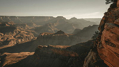
The thin alternating laminae of fine (mud) and coarse (sand) grains, cross-bedding, and graded bedding found in the Mount St. Helens volcanic ash layers that were deposited from slurries moving at hurricane velocity are identical to the thin alternating laminae of fine (mud) and coarse (sand) grains, cross-bedding, and graded bedding found in mudstones and limestones, for example, in the sedimentary layers exposed in the walls of the Grand Canyon. So, it is not illogical at all to conclude those sedimentary layers were similarly deposited by rapidly flowing water. Indeed, it has been verified by repeated and well-documented laboratory experiments that both mud and lime mud sediment layers form under high velocity conditions.8,9,10,11
Lesson Three
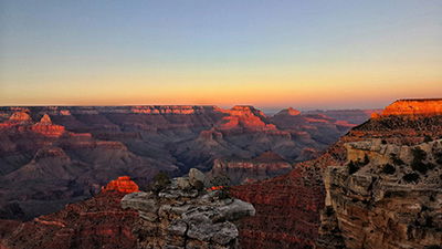
Two major catastrophes combined to produce a mini-Grand Canyon near Mount St. Helens. During the initial blast, more than two-thirds of a cubic mile (2.8 km3) of rock material slid down the side of the volcano, blocking the drainage from Spirit Lake into the Toutle River. It was the largest debris avalanche observed in human history.2 The deposits averaged 150 feet (45 m) thick.
Nearly two years later, on March 19, 1982, the hot volcanic ash from another explosive eruption of Mount St. Helens melted a thick snowpack in the crater, creating a destructive, sheet-like flood of water and mud, which became a mudflow. Reaching the earlier deposits blocking Spirit Lake, the flow cut channels through the debris at a speed of 40 miles per hour (65 km/h). Individual canyons up to 140 feet (43 m) deep appeared in a single day.2,3,4,5 On either side of the canyons were elevated plateaus resembling the North and South Rims of the Grand Canyon.
Side canyons also appeared, resembling the side canyons of Grand Canyon (technically known as gully-headed and amphitheater-headed side canyons). The breach did not cut straight through the obstruction, but took a meandering path, similar to the meandering path of the Grand Canyon through the high plateaus of northern Arizona. Indeed, this “Little Grand Canyon of the Toutle River” is a one-fortieth scale model of the actual Grand Canyon.
This amazing feature was cut through soft debris, but another eruption two months later (on May 19, 1982) melted a snowpack that cut through hard basalt bedrock. The resulting Loowit Canyon was more than 100 feet (30 m) deep. Nearby, the avalanche cut through lava and ash layers to form a third canyon, Step Canyon, up to 600 feet (180 m) deep.
Small creeks now flow through these deep canyons. In other places, geologists assume creeks cut the surrounding canyons very slowly over a very long time period. Yet at Mount St. Helens they know that the canyons formed first and formed extremely rapidly!
The long timescales that geologists assign to the erosion of deep canyons are erroneous. Deep canyons can and do form very rapidly. This includes the Grand Canyon of Arizona—not long after the Noachian flood.
Mount St. Helens demonstrates beyond debate that the sudden release of water cuts canyons rapidly, even carving through hard rock.
What happened at Mount St. Helens demonstrates beyond debate that the sudden release of water cuts canyons rapidly, even carving through hard rock. Special, destructive processes are in play during catastrophes, which we don’t see every day. For instance, when the mud and water flows fast enough, it can cause cavitation, a process that generates vacuum bubbles which implode and inflict hammer-like blows to pulverize rock. Such rapid erosion processes operated on a much grander scale during Noah’s flood itself and also during its aftermath.
Objections
Another AiG supporter wrote in, asking for a response to the following criticisms:
I have read where an old-earth creationist ridiculed Flood geology and brought up a point about canyon formation. He claimed that young-earth creationists are disingenuous when comparing Mount St. Helens to the Grand Canyon, that the water was cutting through different kinds of substances, creating different erosion patterns. He pointed out that young-earth creationists don’t really show the two side by side, because they look too different. This accusation bothers me, especially after seeing a video on YouTube that compared Mount St. Helens and the Grand Canyon. I'm particularly interested to hear what there is to say about the differences between the eroded substances of the Grand Canyon versus Mount St. Helens mud flow erosion, that is, granite versus ash, and the shape of the erosion pattern.
And others object that if the Grand Canyon was eroded by the retreating floodwaters or soon after the flood, the sediment layers in the walls of the newly-carved Grand Canyon would have still been wet and soft and would have slumped into the canyon rather than form the sheer cliffs we see there today.
Response
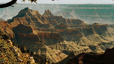
Old-earthers have doctrinaire reasons for seeking to bamboozle people into doubting that the Mount St. Helens canyon reliably illustrates what happened when the Grand Canyon was formed. They are quite correct that the sediment layers at Mount St. Helens were still soft when the canyon system was carved into them, but that’s exactly the point with respect to the sediment layers in the Kaibab plateau through which the Grand Canyon was carved. They are failing to consider the big picture of how and when the sediment layers making up that plateau formed.
In the East Kaibab Monocline, sediment layers of the entire sequence of the Kaibab plateau were folded without the significant fracturing one would expect had those layers become hardened and brittle after deposition hundreds of millions of years earlier. By contrast, the absence of significant fracturing implies that all the layers must have still been soft and pliable to be bent smoothly when the plateau was uplifted.12 In other words, the entire sediment layer sequence had to be deposited within months during the flood year prior to being folded later at the end of or soon after the cataclysm.
So that means the Grand Canyon was carved into those sediment layers after the flood within a few years of them having been deposited.13 That would have given them time to start drying out so they would not have been wet and slumped into the canyon but would have stood up as cliffs. (By the way, this is why the Grand Canyon could not have been carved out as the floodwaters retreated because the sediment layers would have still been wet and thus slumped into the canyon rather than leaving high cliffs.)
In comparison, this was exactly the situation at Mount St Helens. Even though the sediment layers at Mount St. Helens were still soft, they were also dry after being deposited two years earlier. So, the rapid erosion by water and mud carving through those sediment layers produced cliffs more than 100 feet (30 m) high that didn’t collapse after the canyon system formed. And exactly as in the Grand Canyon, the catastrophic canyon carving at Mount St. Helens took a meandering path and produced gully-headed and amphitheater-headed side canyons.
Finally, as for carving through the granite in the Inner Gorge at the bottom of the Grand Canyon, in less than a day on May 19, 1982, a volcanic mudflow carved through solid basalt (undoubtedly involving cavitation as already described) to form Loowit Canyon more than 100 feet (30 m) deep in the side of Mount St. Helens.
Lesson Four
When the volcano initially erupted, the top 1,300 feet (395 m) of its summit was blasted away, leaving an enormous horseshoe-shaped crater. Within days the removal of so much mass from the top of the mountain allowed lava to flow up through a vent at the center of the crater to form a lava dome within the crater.
Five times in subsequent months, explosive eruptions destroyed each growing lava dome. Seventeen successive flows formed a sixth dome in the six years between October 18, 1980, and October 26, 1986. These flows erupted more than 2.6 billion cubic feet (74 million cu. m) of lava to form this sixth dome, which towered 1,150 feet (350 m) above the crater floor.14
In June, 1992 a large sample was collected from the surface of one of the last lava flows, probably from the year 1986. Samples were sent to a radioisotope laboratory in 1996 to be dated using the potassium-argon method. This method measures the amount of argon produced from the radioactive decay of potassium in the lava rock, presumably after it had erupted and cooled. The rock was a mere ten years old, but the potassium-argon “clock” dated the rock at 350,000 years old, and minerals within the rock dated at up to 2.4 million years old.14
Radioactive dating methods are fraught with difficulties that generally render them seriously unreliable.
These results are consistent with many reports in the literature of numerous other historic lava samples from around the world that have similarly yielded highly erroneous potassium-argon ages. One problematic assumption likely responsible for most of the error is that all the argon present in the rock before it melts is lost when melting occurs, causing the clock to be reset to zero. This example illustrates that radioactive dating methods are fraught with difficulties that generally render them seriously unreliable. The research of the Radioisotopes and the Age of the Earth (RATE) team, published in 2005, provided multiple independent lines of radioisotope evidence showing the chief reasons why these methods are unreliable and why the biblical timeframe is the correct one.
Objections
Another relevant request from a supporter details some criticism:
An old-earth creationist friend that I have been debating with accuses Answers in Genesis of deliberately using the wrong dating method (potassium-argon) regarding the Mount St. Helens volcanic rock, in order to get a false age, and then using that result to demonstrate that that method is invalid. So, the accusation is deception and lying. Please help me set the record straight.
In addition, Dr. Steve Austin who did the potassium-argon dating study, has been accused of not being careful enough with the sample he submitted to the dating laboratory to make sure it didn’t contain any minerals or rock pieces from the volcano’s conduit incorporated in the lava during its upwards passage to eruption. That would have made his lava sample older than what it really was.
Response
Both criticisms are uninformed and disingenuous. The use of potassium-argon dating on young and historic lava flows is well documented in the scientific literature.15 Geochronologist G. Brent Dalrymple (who has made similar criticisms of Dr. Austin) himself used the argon-argon variant of potassium-argon dating to investigate 26 historic lava flows and similarly found five of those flows in Hawaii, Italy, California, and Arizona to yield erroneous old ages.16 The same method is still used today to date young and historic lava flows, so this criticism is ill-informed and/or hypocritical.
Furthermore, as is standard practice, during his investigation Dr. Austin made thin sections of his Mount St. Helens lava dome sample so that he could carefully examine the minerals and texture of the rock under a geologic microscope. In that way he was meticulous to make sure the sample he sent to the dating laboratory didn’t contain any foreign older minerals or rock pieces that might have been added to the lava during its transit from depth prior to erupting onto the crater floor. In his technical paper he even included a photograph of the rock under the microscope. The photo also appeared on the cover of the journal that published his paper.14 Anyone can thus check for themselves that no foreign “old” minerals or rock pieces were in his sample.
Conclusion
The eruption of Mount St. Helens and its aftermath provided a rare opportunity to study geologic processes during a catastrophe.
The May 18, 1980, eruption of Mount St. Helens and its aftermath provided a rare opportunity to study geologic processes during a catastrophe. Within a few months they produced changes that most geologists assume require many thousands, or even millions, of years. The eruption and its aftermath challenged, and still challenges forty years later, in a profound way, the slow and gradual interpretation of the formation of the geologic record, and the erosion of landscape features that underpins the Darwinian worldview. The objections of skeptics are unfounded, yet they are repeatedly used as a smokescreen to avoid the obvious implications of the evidence. Indeed, the eruption and its aftermath provide vivid illustrations of the cataclysmic power of the Genesis flood, which reshaped the surface of the entire earth in the span of but a single year and its aftermath.
See the video with Dr. Snelling and Ken Ham, recorded last week, to discuss this important event.
Footnotes
- Peter W. Lipman and Donald R. Mullineaux (eds.), The 1980 Eruptions of Mount St. Helens, Washington, US Geological Survey Professional Paper 1250, DOI: 10.3133/pp1250.
- Steven A. Austin, “Mount St. Helens and Catastrophism,” Proceedings of the First International Conference on Creationism, vol. 1 (Pittsburgh, Pennsylvania: Creation Science Fellowship, 1986), 3–9.
- J. Morris and Steven A. Austin, Footprints in the Ash: The Explosive Story of Mount St. Helens (Green Forest, Arkansas: Master Books, 2003).
- Steven A. Austin, “Why is Mount St Helens Important to the Origins Controversy?” in K. Ham, editor, The New Answers Book 3 (Green Forest, Arkansas: Master Books, 2010), chapter 26, 253–262 (accessible at https://answersingenesis.org/geology/mount-st-helens/why-is-mount-st-helens-important-to-the-origins-controversy/).
- Steven A. Austin and Kyle Justice, Mount St. Helens: Modern Day Evidence for the World Wide Flood, DVD (Compel Media, 2012).
- Harold G. Coffin, "Mount St. Helens and Spirit Lake," Origins 10 (1983): 9–17.
- Harold G. Coffin, "Erect Floating Stumps in Spirit Lake, Washington," Geology 11 (1983): 298–299.
- Andrew A. Snelling, “Mudrocks in Minutes,” Answers 13, no. 3 (2018): 38–39.
- Joe H. S. Macquaker and Kevin M. Bohacs, “On the Accumulation of Mud,” Science 318 (2007): 1734–1735.
- Juergen Schieber, John B. Southard, and Kevin Thaisen, “Accretion of Mudstone Beds from Migrating Floccule Ripples,” Science 318 (2007): 1760–1763.
- Juergen Schieber, John B. Southard, Patrick Kissling, Brit Rossman, and Robert Ginsburg, “Experimental Deposition of Carbonate Mud from Moving Suspensions: Importance of Flocculation and Implications for Modern and Ancient Carbonate Deposition,” Journal of Sedimentary Research 83, no. 11 (2013): 1025–1031.
- Andrew A. Snelling, “Rock Layers Folded, Not Fractured,” Answers 4, no. 2 (2009): 80–83 (accessible at https://answersingenesis.org/geology/rock-layers/rock-layers-folded-not-fractured/).
- Andrew A Snelling and Tom Vail, “When and How Did the Grand Canyon Form?” in K. Ham, editor, The New Answers Book 3 (Green Forest, Arkansas: Master Books, 2010), chapter 18, 175–187 (accessible at https://answersingenesis.org/geology/grand-canyon-facts/when-and-how-did-the-grand-canyon-form/).
- Steven A. Austin, “Excess Argon within Mineral Concentrates from the New Dacite Lava Dome at Mount St Helens Volcano,” Creation Ex Nihilo Technical Journal 10, no. 3 (1996): 335–343 (accessible at https://answersingenesis.org/geology/mount-st-helens/argon-in-mineral-concentrates-from-mount-st-helens-volcano/).
- Andrew A. Snelling, “The Cause of Anomalous Potassium-Argon ‘Ages’ for Recent Andesite Flows at Mt. Ngauruhoe, New Zealand, and the Implications for Potassium-Argon ‘Dating’,” Proceedings of the Fourth International Conference on Creationism (Pittsburgh, Pennsylvania: Creation Science Fellowship, 1998), 503–525.
- G. Brent Dalrymple, “40Ar/36Ar Analyses of Historic Lava Flows,” Earth and Planetary Science Letters 6 (1969): 47–55.
Support the creation/gospel message by donating or getting involved!

Answers in Genesis is an apologetics ministry, dedicated to helping Christians defend their faith and proclaim the good news of Jesus Christ.
- Customer Service 800.778.3390
- Available Monday–Friday | 9 AM–5 PM ET
- © 2026 Answers in Genesis