
My Recent Arch Trip to Utah
In a recent blog post, I discussed my fascination (obsession?) with natural arches. In that blog post, I also discussed my theory of how Rock Bridge, my favorite arch, formed. I mentioned that I would soon travel to Utah to examine the three natural bridges of Natural Bridges National Monument that formed by the same mechanism that I propose for Rock Bridge. I am back from my trip, so I happily report on that trip in this blog post.
The Outbound Trip
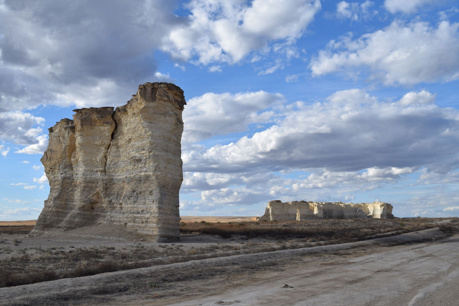
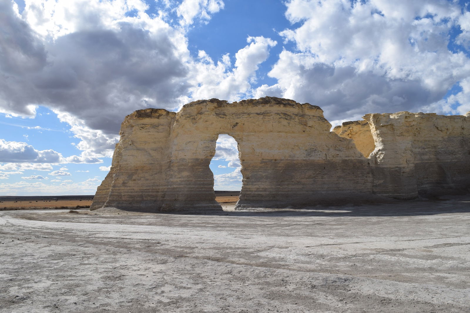
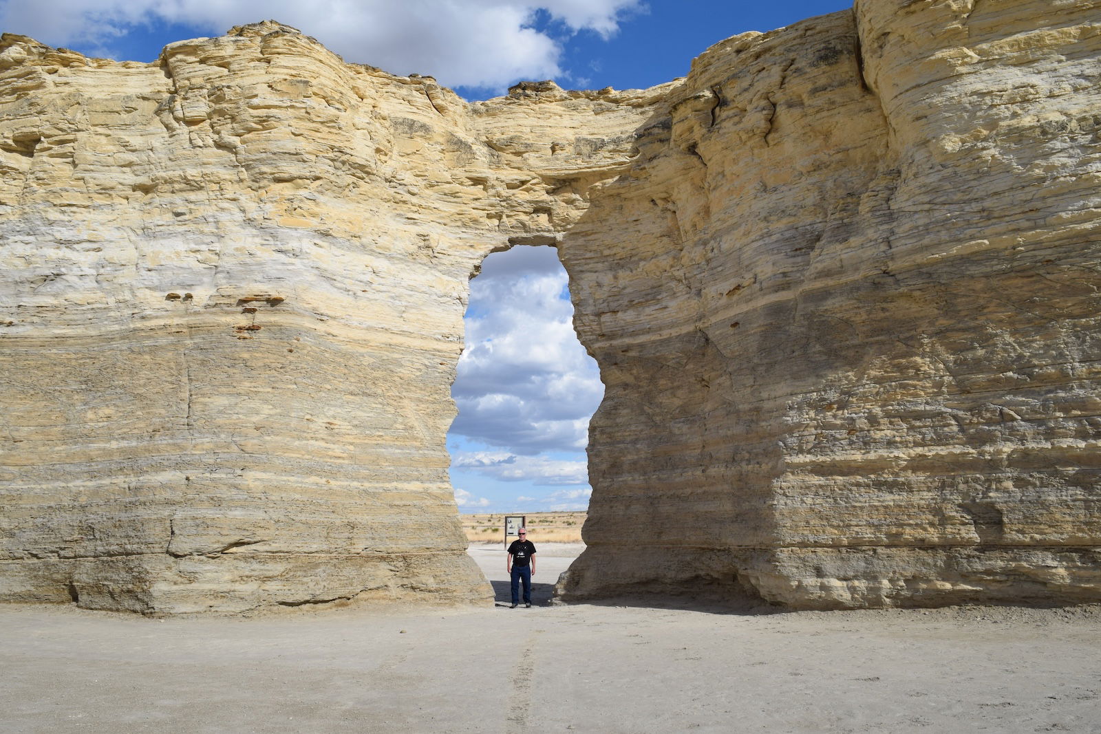
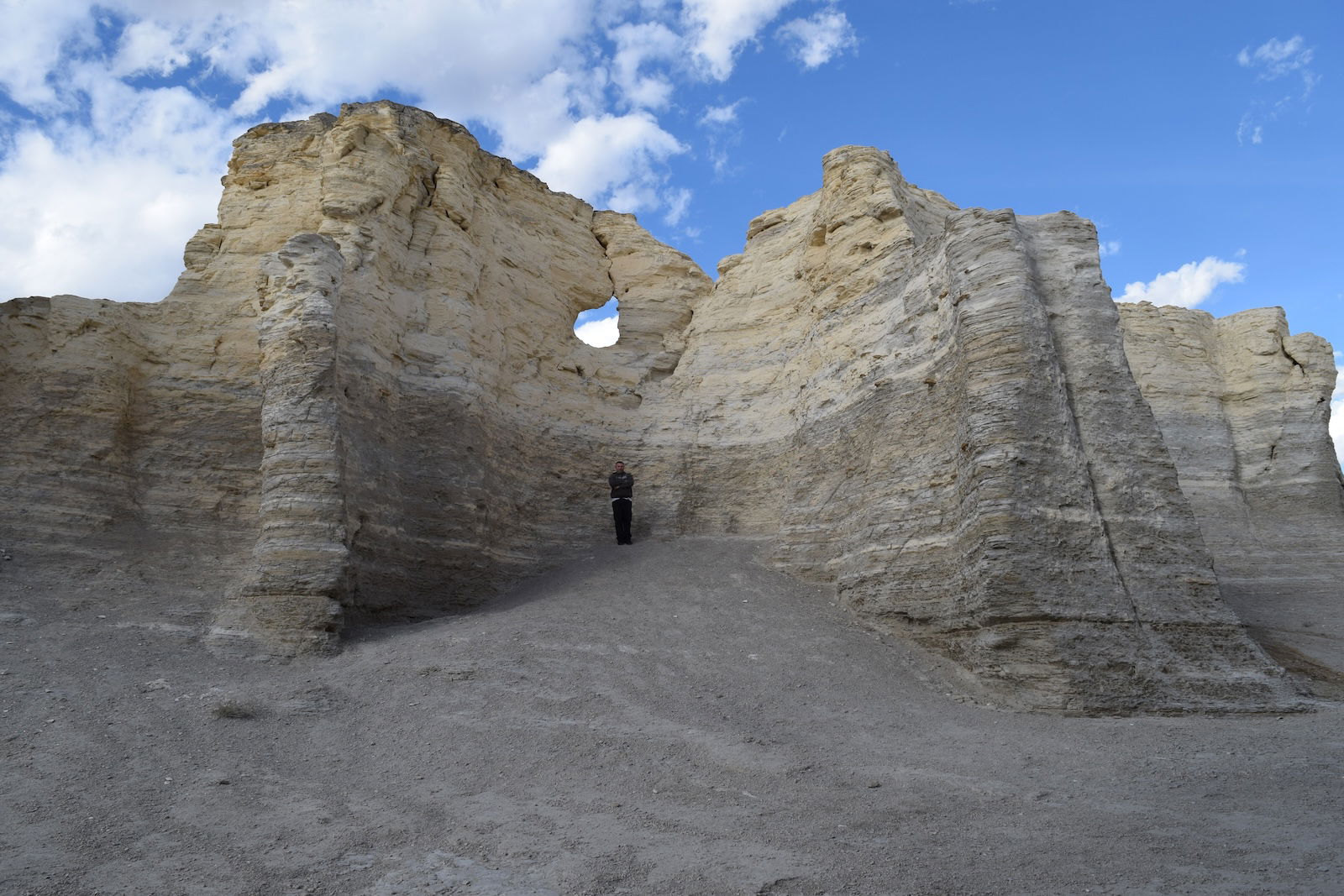
I was accompanied on the trip by Eric Glover, who works in housekeeping at the Creation Museum and has been my usual hiking buddy in Red River Gorge for nearly six years. We left Northern Kentucky early Tuesday morning, March 25. Late in the afternoon, we stopped in western Kansas to see two arches in Monument Rocks. Monument Rocks are two groups of small buttes of chalk. The rest of the chalk layer has eroded away, leaving these solitary stones that resemble monuments. Monument Rocks has some protection of a cap of harder rock, but the chalk is eroding quickly. I don’t know if these arches have names; I’ll just call them Monument Rocks Arch and Monument Rocks Window . Given the fragility of the chalk, these two arches could collapse at any time. I’ve now seen arches in sandstone, limestone, basalt, and chalk.
We drove almost 1,100 miles that first day, spending the night in a hotel in Limon, Colorado. It made for a long day, but we had left well before dawn, and we were traveling with the sun, which gave us an extra hour or more of the sun. Driving so long on the first day allowed us to travel more leisurely the additional 450 miles or so the next day through the Rocky Mountains to Moab, Utah. We were scheduled to meet Nate Loper and Nathan Mogk at Natural Bridges National Monument Friday, so we were far ahead of schedule.
-
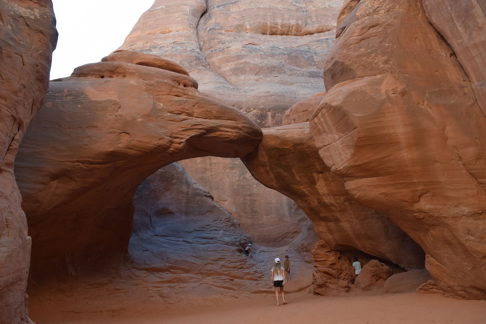
Sand Dune Arch
-
Diamond Arch
-
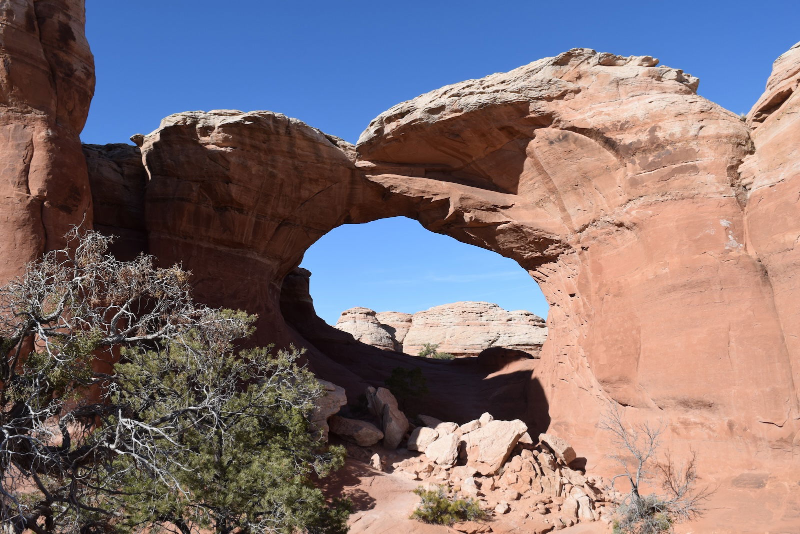
Broken Arch
-
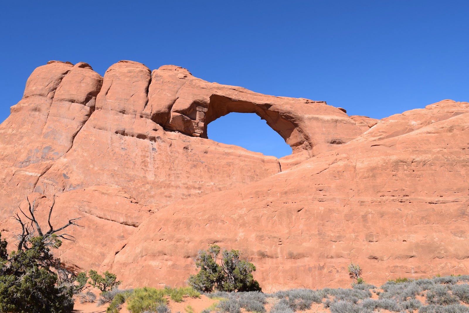
Skyline Arch
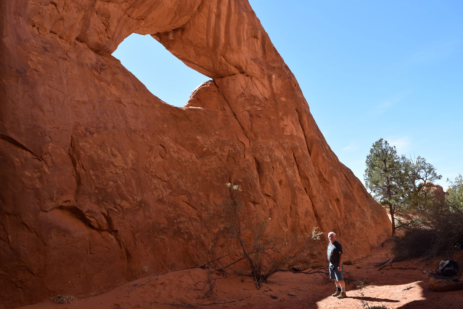
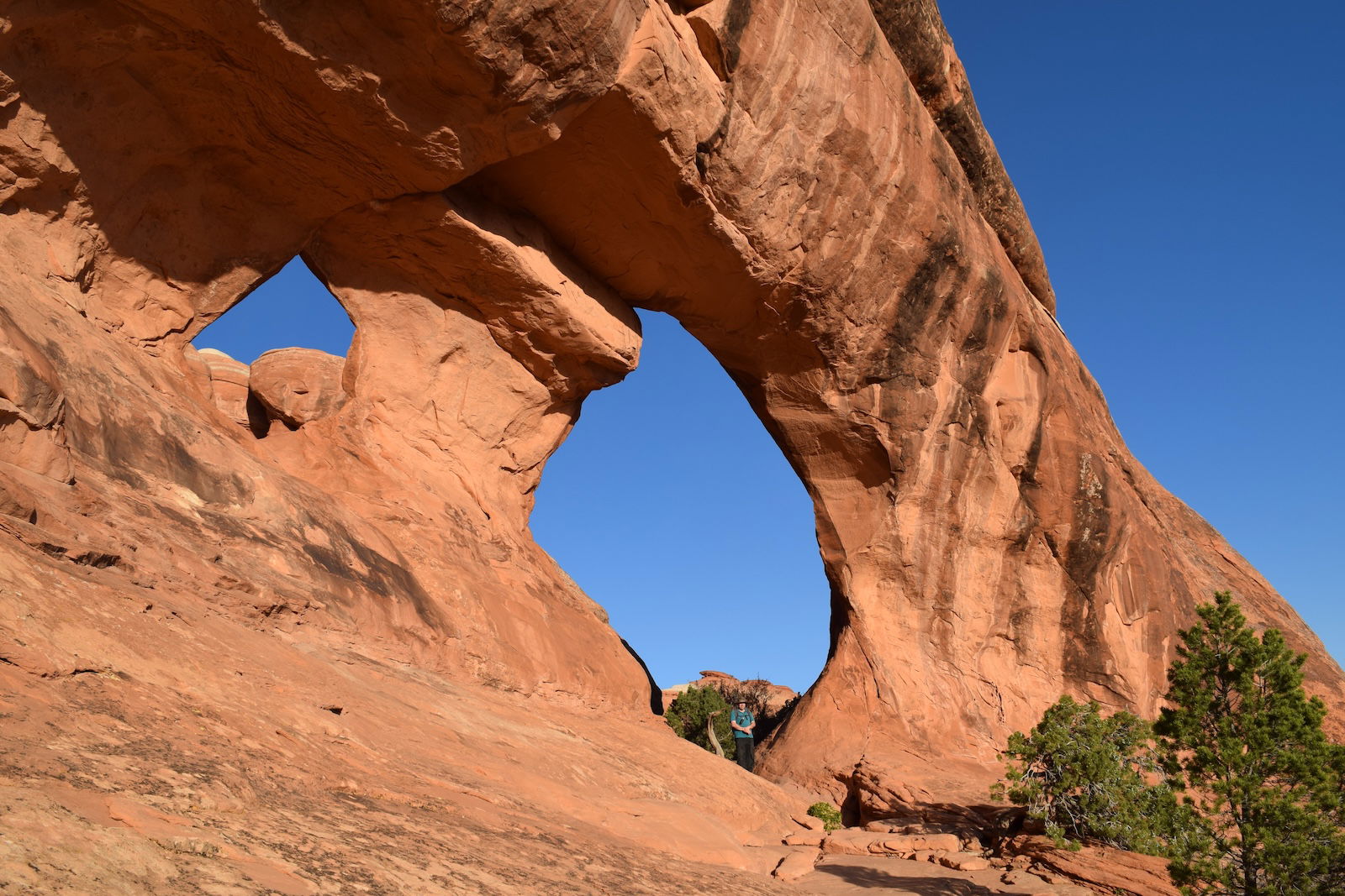
Since we arrived in Moab by midafternoon Wednesday, we entered Arches National Park and hiked a bit to see arches near the park’s campground. Some of the notable arches there are Sand Dune Arch, Diamond Arch, Broken Arch, and Skyline Arch (every time I looked at that arch, I had craving for chili). Next, we hiked up to Delicate Arch . I had been to Delicate Arch on a previous trip, but Eric had not seen this iconic arch yet. Late in the day, we found a hotel room in Moab, but we returned to the park early on Thursday to explore the Devil’s Garden. We began our hike 40 minutes before sunrise, so for a while, we had the place to ourselves. First up was Landscape Arch, the largest arch in the United States. It is impressive, but it is also fragile—people have observed at least one piece falling off. Other outstanding arches that we saw included Partition Arch, Navajo Arch, Double O Arch, Private Arch, and Box Arch. There were many other arches, some apparently without names, that were too numerous to mention. Late in the day, we left the park and headed south, spending the night at a hotel in Monticello.
-
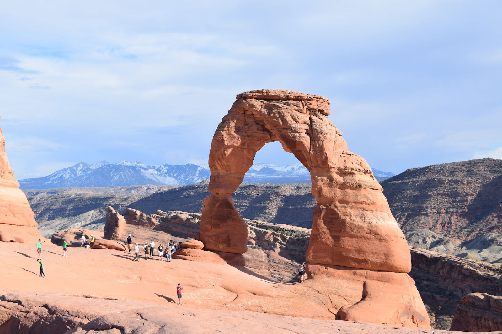
Delicate Arch
-
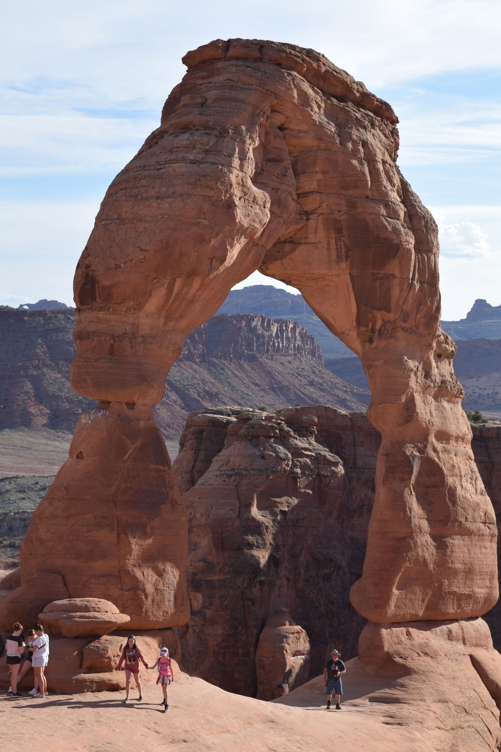
Delicate Arch
-
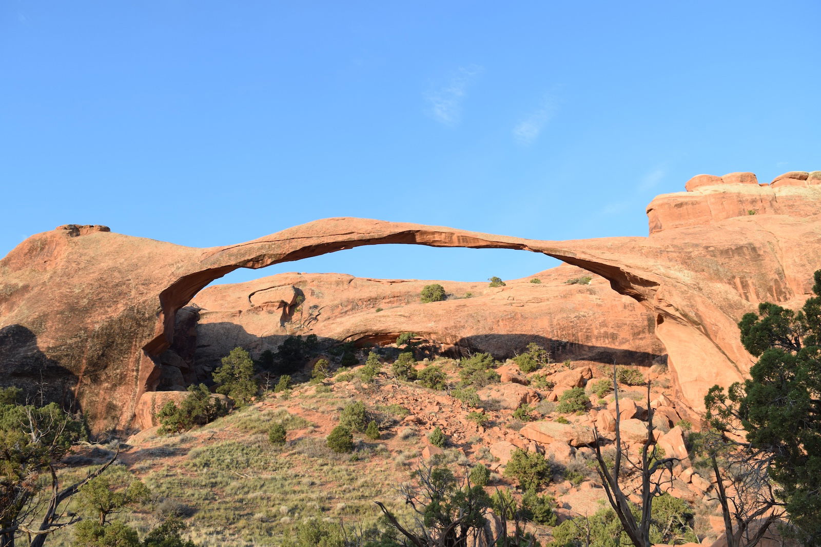
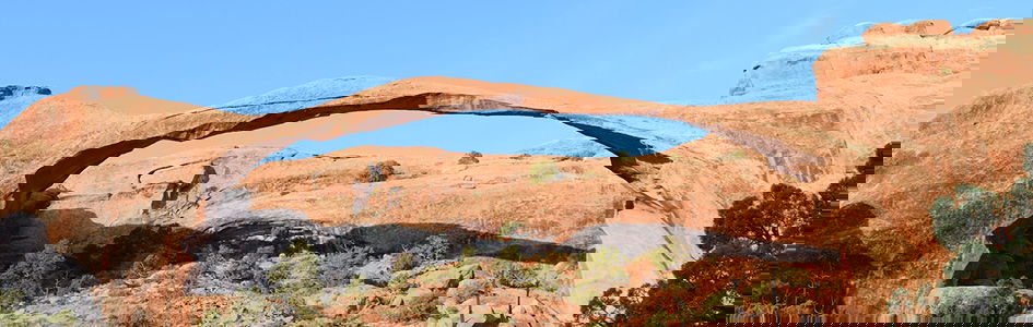
Landscape Arch
Since we didn’t have to meet Nate and Nathan until Friday afternoon, we took our time driving to Natural Bridges National Monument. Along the way, Eric spotted an arch complex next to the highway, so I turned around so that we could measure its location and take some photos. For nearly six years, I have been recording the latitude, longitude, and elevation of each arch that I visit. I plot these on a map so that I have a good sense of where the arches I have visited are.
-
Partition Arch
-
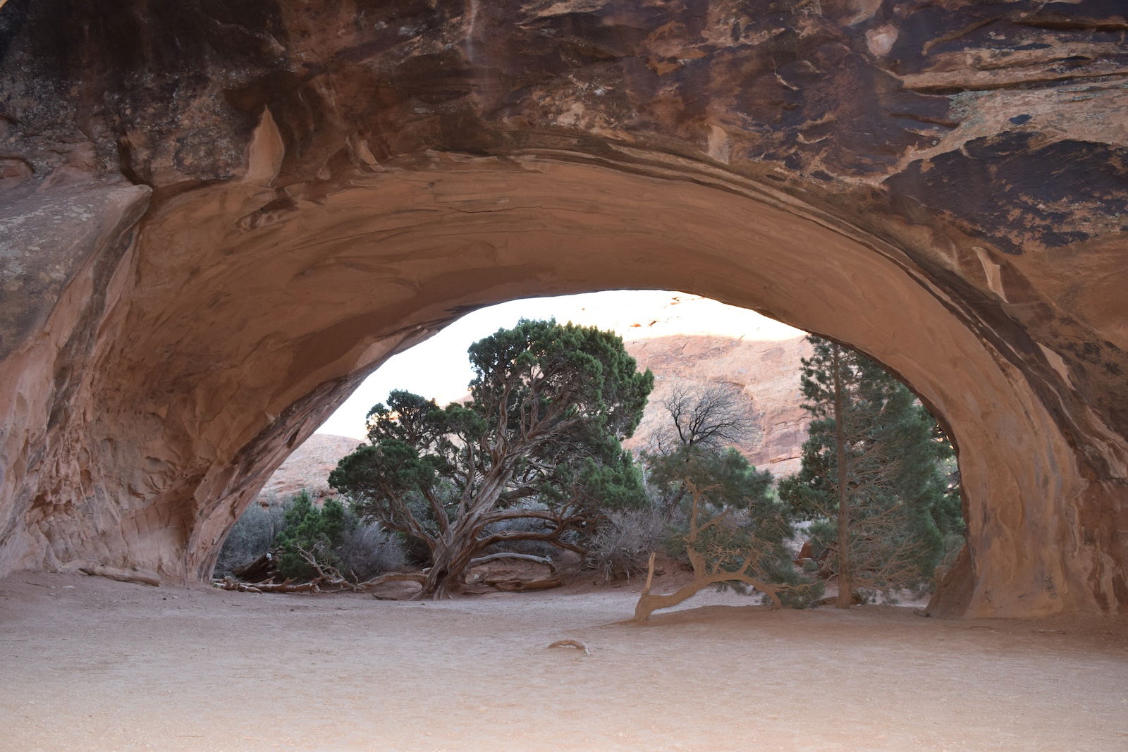
Navajo Arch
-
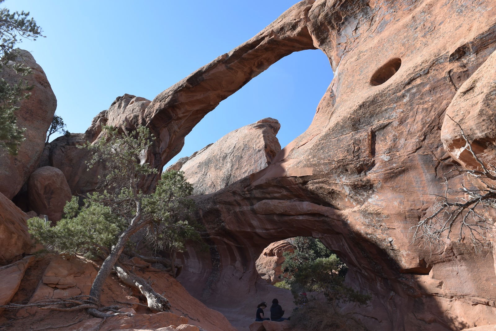
Double O Arch
-
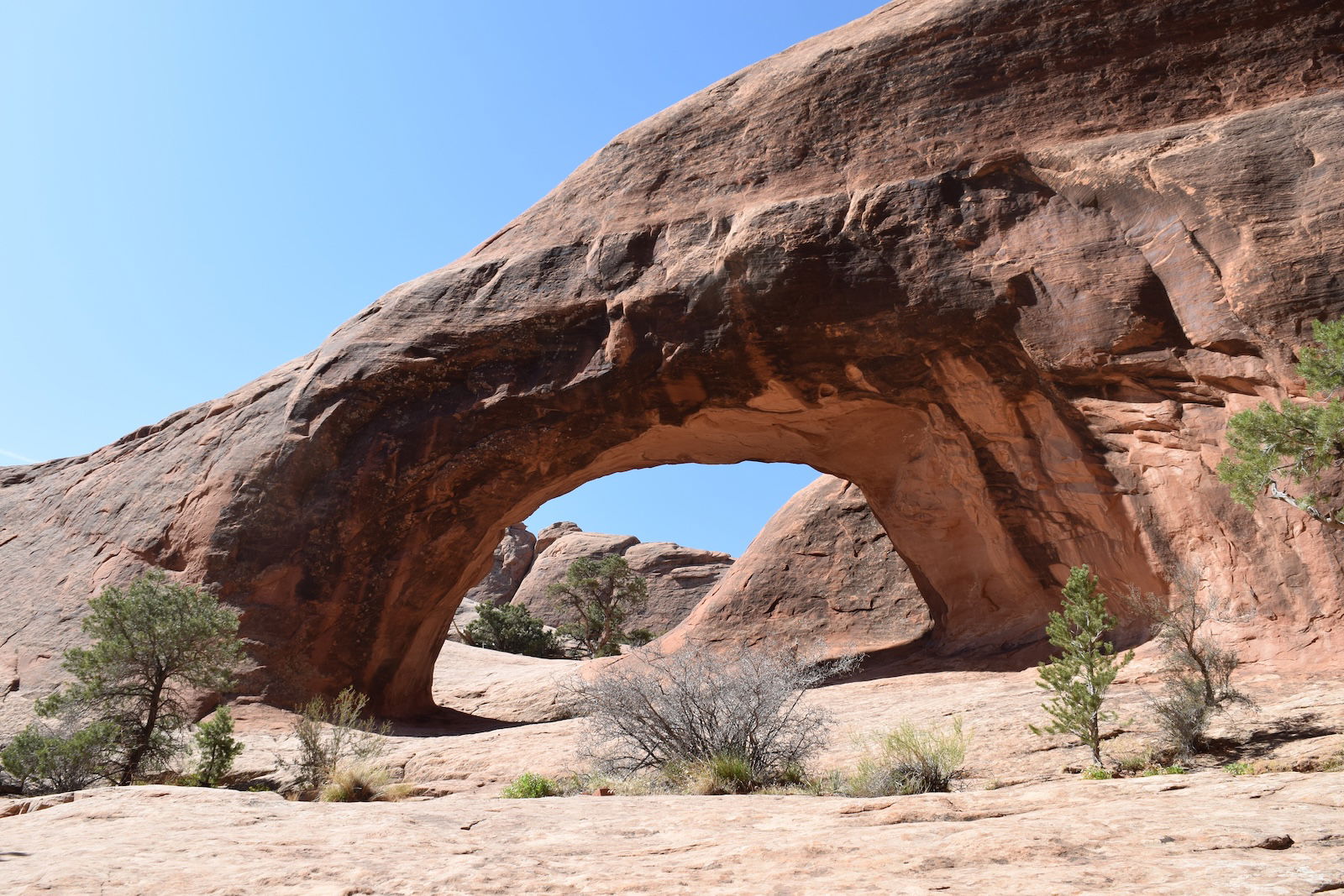
Private Arch
-
Box Arch
-
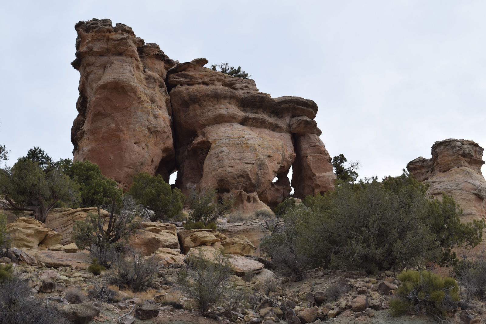
Utah-95 Arch
Natural Bridges National Monument
We arrived at Natural Bridges National Monument a few hours before Nate and Nathan, so Eric and I spent some time at the visitor center, and then we set up the campsite that Nate had reserved for Friday evening. Once Nate and Nathan arrived, the four of us went to Owachomo Bridge, one of the three natural bridges in the national monument. For the record, a natural bridge is an arch that has a stream flowing through it. Therefore, many arches that are called bridges are not true bridges. For instance, Natural Bridge and Sky Bridge in Red River Gorge are not true bridges because there is no stream underneath them. However, Virginia’s Natural Bridge is a true bridge, for there is a small stream flowing through it. And Rock Bridge is a true bridge because Swift Camp Creek flows through it. Given that distinction between a true bridge and an arch, I must object to calling the three large arches on Natural Bridges National Monument bridges because usually there is no water flowing under them. I guess that people in the very dry Southwest have a different definition of what a stream is.
Since the canyons in the Southwest are here, it is obvious that there once was a considerable flow of water to form those canyons.
Since the canyons in the Southwest are here, it is obvious that there once was a considerable flow of water to form those canyons. Each of the three large arches of Natural Bridges National Monument formed when a gooseneck meander was shortened by water cutting through the rock wall of the meander. Further erosion lowered the bed of the flow, leaving the now unused meander at a higher level than the bottom of the canyon today. I propose a similar mechanism for the formation of Rock Bridge because there is a U-shaped channel to one side of Rock Bridge that is higher than the creek passing through Rock Bridge. The purpose of my trip was to investigate how the three arches in Natural Bridges National Monument formed so that I could better understand how Rock Bridge formed. I invited Nate and Nathan along to help me with my understanding of geology, and they were happy to oblige me since they had their own research that they wanted to conduct. Eric? He was there for the ride, and what a ride it was! (We saw more than 50 arches on our trip.)
I think Nathan wanted to visit Owachomo Bridge first because it is the most difficult of the three arches to understand. We spent a lot of time examining the area of Owachomo Bridge. Owachomo Bridge is just downstream from where Tuwa Canyon joins Armstrong Canyon. There is an abandoned channel north and high above the current canyon bottom. Owachomo Bridge is through an isolated ridge between the channel and the current canyon. If the abandoned channel were the original course of the drainage of Armstrong Canyon, then the part of the canyon south and to the west of the ridge in which Owachomo Bridge is did not yet exist when the bridge formed. The best solution to this problem is that Armstrong Canyon always drained to the south of the isolated ridge, and the abandoned channel is the original end of Tuwa Canyon. The flow in Tuwa Canyon cut through the ridge to join Armstrong Canyon upstream, forming Owachomo Bridge in the process. But Tuwa Canyon probably breached the ridge a second time farther upstream. A second arch that may have formed with that second breach subsequently collapsed, leaving behind the current end of Tuwa Canyon where it joins Armstrong Canyon. Satisfied with this explanation, we returned to our campsite for the evening.
-
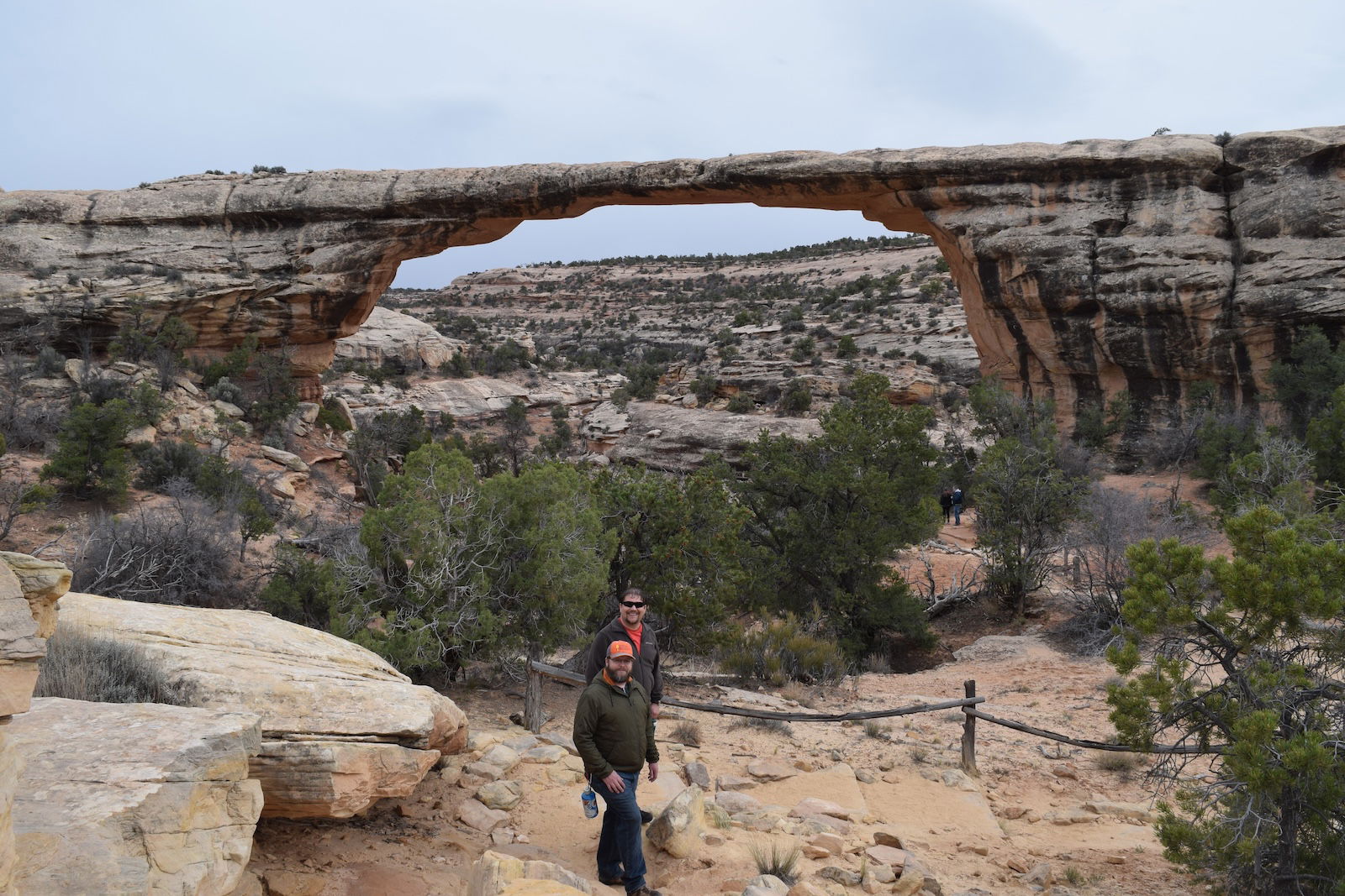
Owachomo Bridge
-
Owachomo Bridge
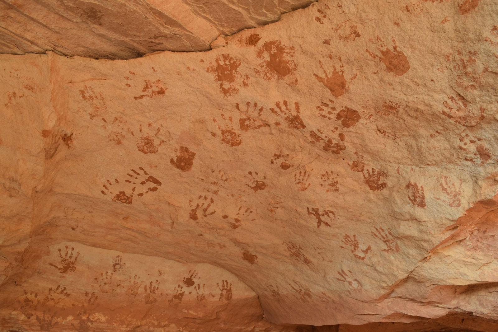
The next morning, Nate went to Kachina Bridge to investigate some archaeology around that arch. Meanwhile, Nathan, Eric, and I returned to Owachomo Bridge. There is a trail at the bottom of the canyons that connects all three bridges. After descending once again to below Owachomo Bridge, we followed the trail downstream in Armstrong Canyon as it extends to the northwest to join White Canyon. Kachina Bridge is at the confluence of Armstrong Canyon and White Canyon. Unlike Owachomo Bridge, there is no mystery about the formation of Kachina Bridge—there is an abandoned channel east of the current flow in White Canyon. The abandoned channel is a meander that was cut off when Kachina Bridge formed in a ridge extending from the west side of White Canyon. We met Nate there, and he showed us some ruins and petroglyphs. Nate hopes to share his conclusions about one of the petroglyphs at the Creation Research Society meeting in St. Louis this summer.
-
Kachina Bridge
-
Kachina Bridge
After lunch, Nate continued his work at Kachina Bridge as the three of us hiked up White Canyon toward the northeast. Downstream, White Canyon makes its way to the northwest, where it eventually flows into Lake Powell. Later I noticed on a map that shortly downstream from where we left White Canyon, White Canyon passes through a deep, broad water gap. To me, that suggests two impulsive events, one to form the water gap, and the other to scour the canyon within the water gap.
-
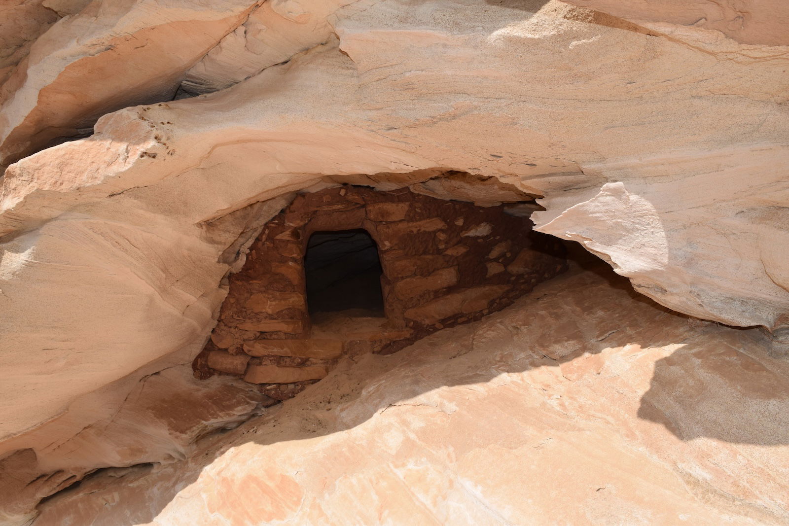
Archaeological Site
-
Archaeological Site
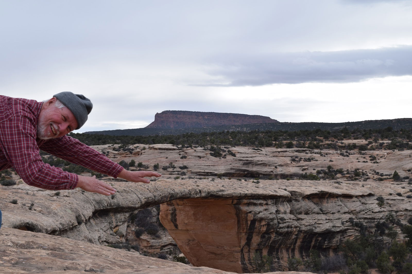
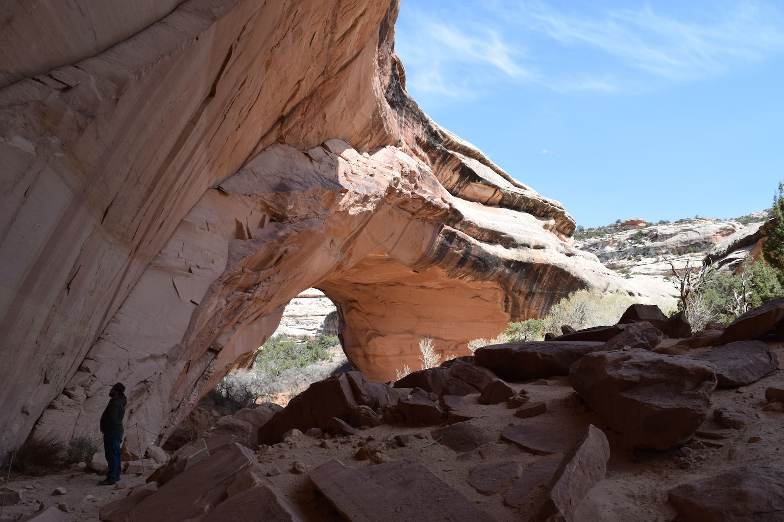
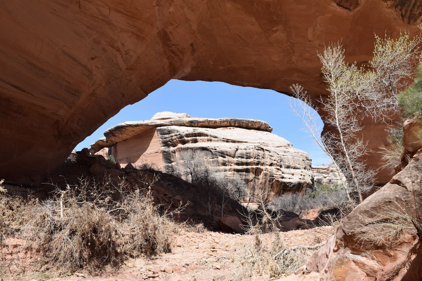
Between Kachina Bridge and Sipapu Bridge, we saw several archaeological sites, such as some pueblo and a granary. We also spotted several arches, most of which probably don’t have names. Finally, we reached Sipapu Bridge, followed by the climb out of the canyon. According to the topographic maps, the elevation change coming out was only 550 feet, but it seemed more than that. Perhaps it was the elevation above sea level. All our hiking in Utah had been over a mile high, so we got winded very easily. From the photos , you can see that the hike out is not for everyone. In the view from above, you can see light passing through Sipapu Bridge, and the abandoned channel going around the arch.
-
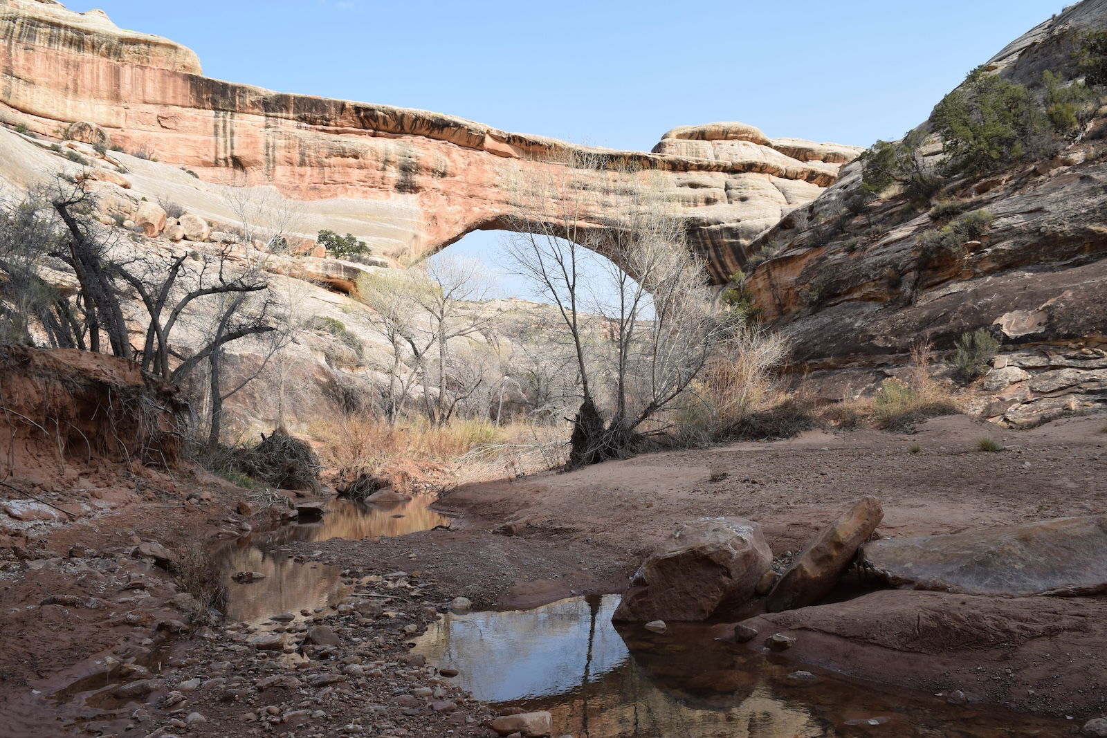
Sipapu Bridge
-
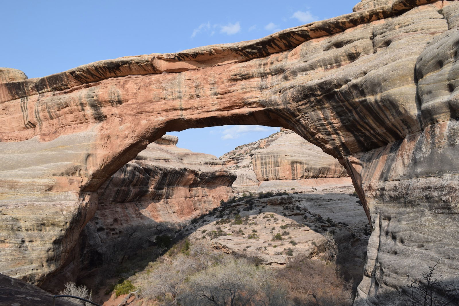
Sipapu Bridge
-
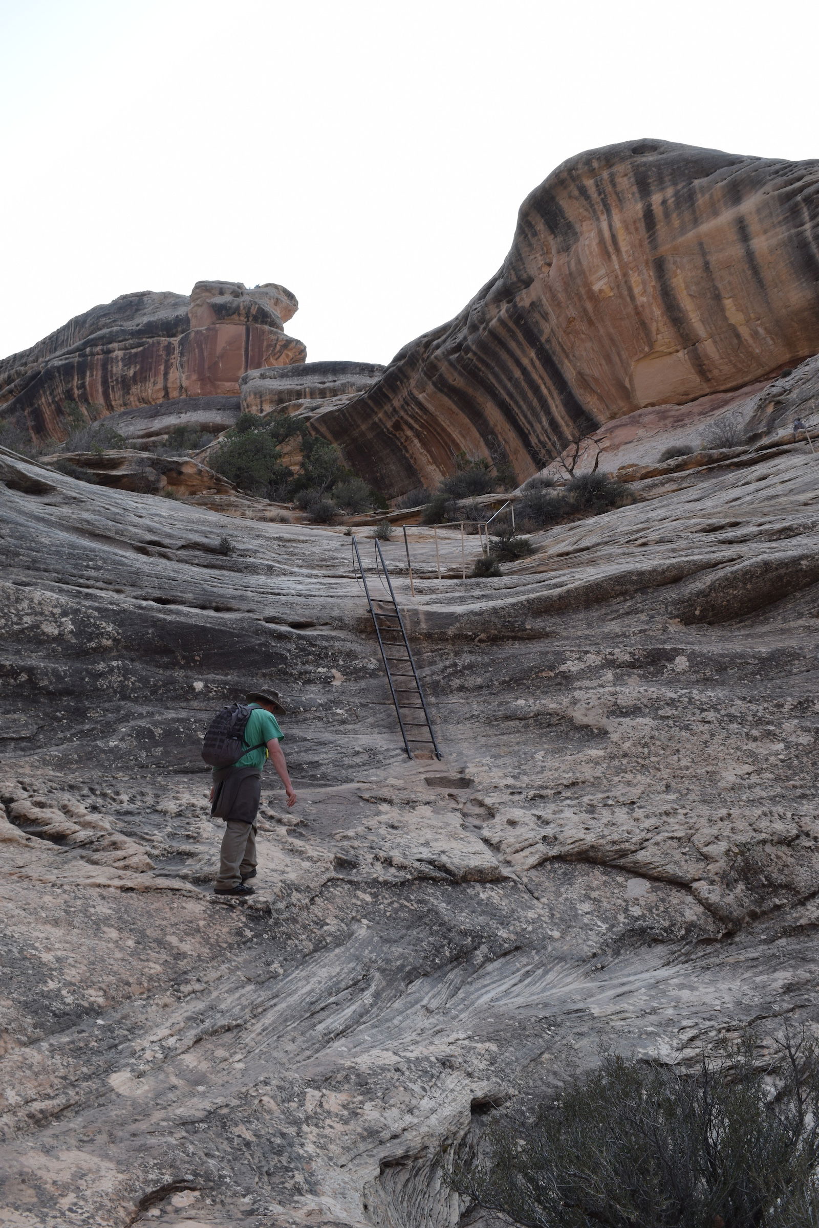
Sipapu Bridge Trail
-
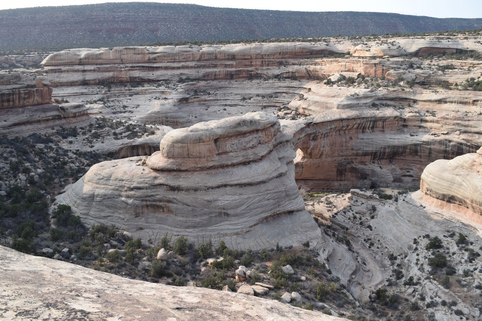
Sipapu Bridge
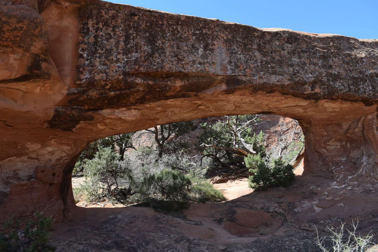
While we had taken the hike down to Owachomo Bridge twice and hiked up from Sipapu Bridge once, we had not taken the hike down to or up from Kachina Arch. We had the latitude and longitude of Kachina Trail Arch, and we knew it was along that last trail we had not hiked, so we drove to the parking area for Kachina Bridge in search of this last arch. Almost immediately, we saw this small arch along the trail. At first, we thought that this was Kachina Trail Arch, but the position was not right, so we went down the trail farther. Almost to where we had been earlier in the day, we found Kachina Trail Arch. That is a nice little arch.
-
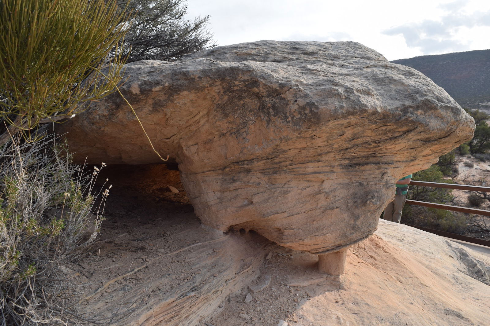
Arch
-
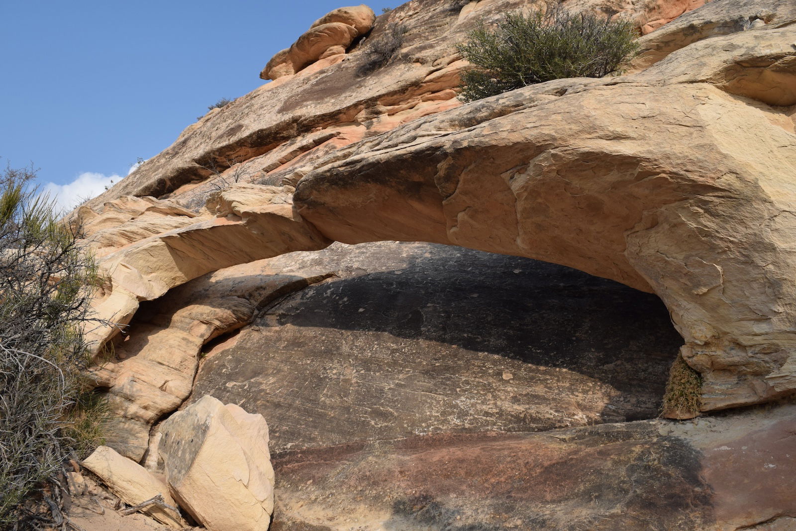
Kachina Trail Arch
We couldn’t camp at the Natural Bridges National Monument campground Saturday night, so Nate helped us find a campsite on Bureau of Land Management land before driving back to Flagstaff. There was no charge to camp, but there were no facilities either. After dark, it snowed briefly.
In Search of Neville’s Arch
Sunday morning, we went in search of arches southwest of Natural Bridges National Monument. After one false start, we decided on hiking to Neville’s Arch, an impressive arch in Owl Creek Canyon. Alas, by early afternoon, we realized that we didn’t have time to reach Neville’s Arch and get out of the canyon before sunset, so we made the tough decision to turn around. The trip was not without value, for we saw some Indian ruins and spotted some smaller arches. However, we did have to ascend 1,100 feet to get out of the canyon. Furthermore, all the way the trail was a bit sketchy, with some steep drop-offs and some rough terrain.
-
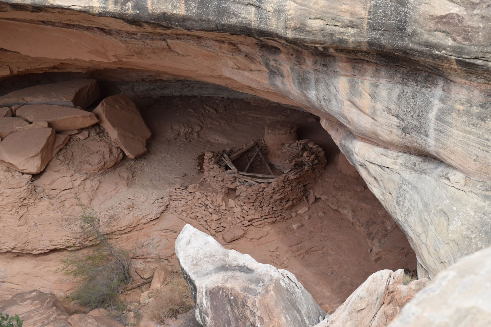
Owl Creek Canyon Ruins
-
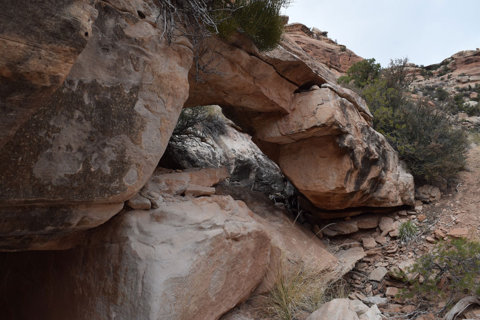
Owl Creek Canyon Arch
The Inbound Trip
Since Wednesday, Eric and I had hiked 45 miles, some of it a bit challenging, and we were tired and sore. Therefore, we made the decision to start heading home. We drove a couple of hours to Durango, Colorado, where we spent the night in a hotel. I slept a full eight hours that night, something that I rarely do. In the morning, I was refreshed, and I easily could have hiked some more, but we had made our decision. Along the way on Monday, we drove over Wolf Creek Pass at nearly 11,000 feet elevation. I have driven I-70 through the Rockies a few times, but I liked this southern route through Colorado much better. Later in the day, we stopped briefly at Great Sand Dunes National Park and Reserve . Afterward, we drove onto Hays, Kansas, where we spent the night. On Tuesday, we arrived home in time for dinner.
-
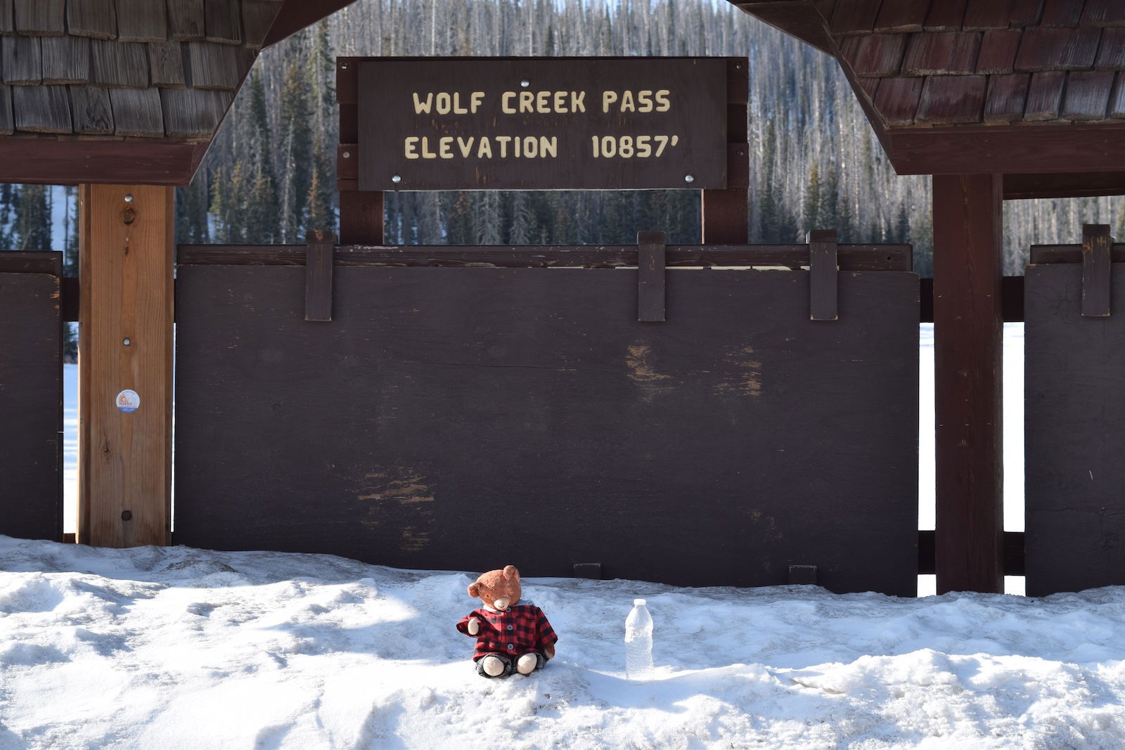
Wolf Creek Pass
-
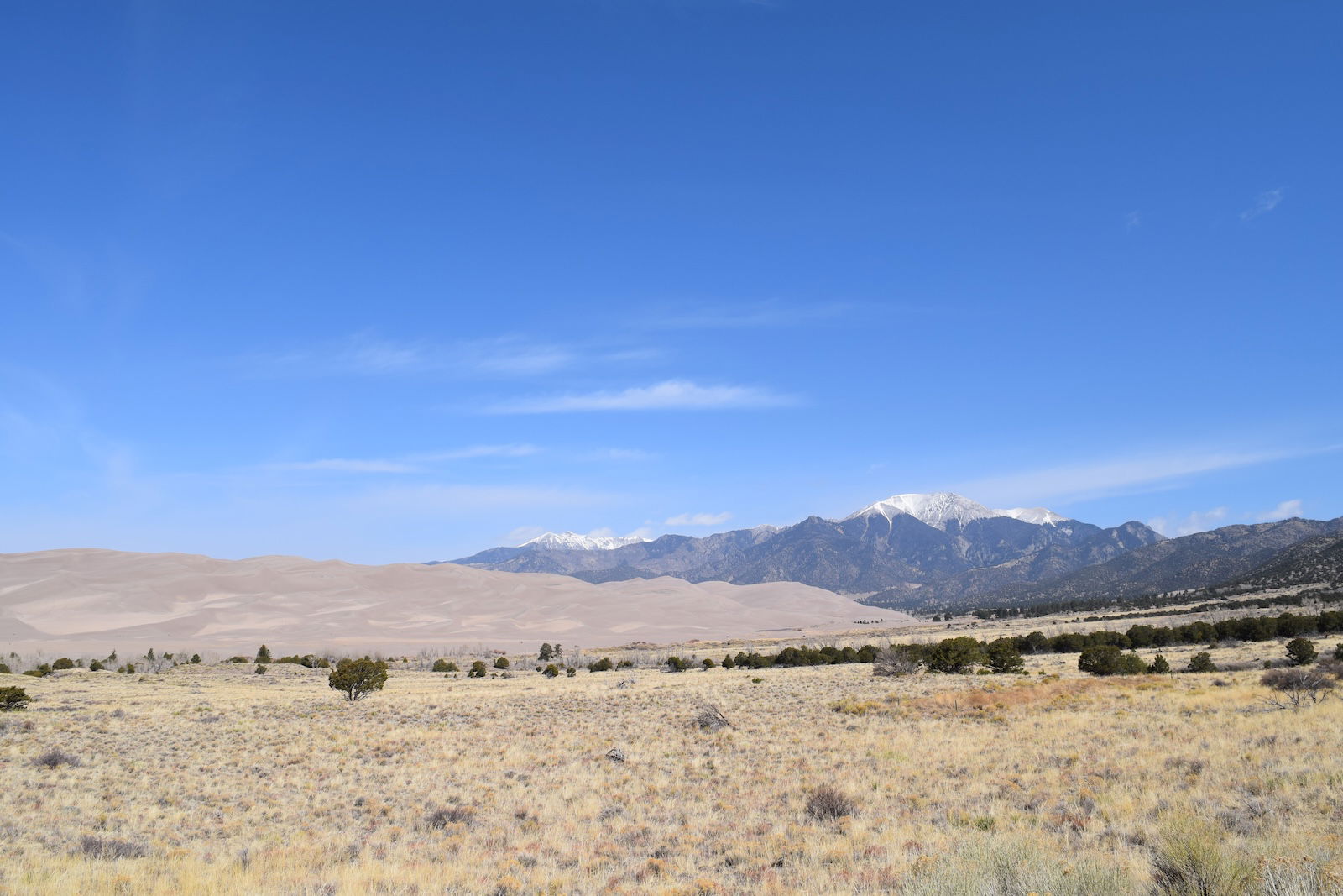
Great Sand Dunes
What Did I Learn on This Trip?
The primary objective of my trip was to investigate arches that formed by the same mechanism that I think formed Rock Bridge. Having seen those other arches, I am even more convinced of my theory of how Rock Bridge formed.
Having seen those other arches, I am even more convinced of my theory of how Rock Bridge formed.
But I learned far more about arches on this trip. For instance, I’ve noticed a systematic difference between Kentucky’s arches and Utah’s arches. It is obvious that Utah has some very large arches, far larger than any arch in Kentucky (though Natural Arch in McCreary County rivals some of Utah’s arches). Early in our arch hunting in Red River Gorge, Eric and I developed a five-point scale for rating arches, with one being the lowest score and five being the greatest score. Size is the primary criterion that we consider, with aesthetics playing a minor role. Our rating system is subjective, and we didn’t intend it to have any scientific value. Rather, we merely wanted a way for other people to decide which arches they wanted to visit. However, with nearly 400 Red River Gorge arches evaluated with our scale, our system gives a qualitative measure of arch sizes, and the distribution of the sizes in our system shows that at least in Red River Gorge, the number of arches increases with decreasing arch size. We observe the minimum criterion for an arch being an opening of at least 36 inches in at least one direction. Therefore, we do not note the position of windows that fail to meet the minimum size, nor do we rate them. It has been our observation that very small openings increase in number even down to openings only an inch or so across. That is, there is a nearly exponential increase in the number of openings with decreasing size. On our trip, I was struck by the lack of small openings in Utah. This means that the distribution of arch sizes in Utah is very different from Red River Gorge. This probably is due to differences between the Corbin Sandstone and the sandstone of Utah’s arches, but it may also be related to differences in how the arches formed.
I now question the number of arches in Arches National Park. It is often claimed that Arches National Park has more than 2,000 arches, giving the park the crown as the greatest number of arches in the United States. Meanwhile, Red River Gorge is often credited as having the second greatest number of arches in the United States. In vain, I searched online for a list or a count of the number of arches in Arches National Park. On this trip, Nate told me that he has asked park staff about a list or count of arches, but they told him that the National Park Service has neither a list nor a count. Arches National Park contains nearly 77,000 acres of land. If there are 2,000 arches in the park, that works out to an average of 0.026 arches per acre. But the arches in Arches National Park are found only within large sandstone outcroppings, particularly among the fins. Much of the park is rolling scrubland where there are no arches. Examining detailed maps of the park, I estimate that, at best, 10% of the land in the park is arch-dense territory. Therefore, for there to be 2,000 arches in the park, the portions of the park rich in arches would have to have 0.26 arches per acre, or about one arch for every four acres. Having now hiked in five parts of the park where some of the more memorable arches are found, is the arch density that great? I am doubtful. It is possible that the arch density is greater than this in parts of the park that I have not visited, such as Fiery Furnace. I will attempt to determine an arch density from the 40 arches that I have seen in Arches National Park, recognizing that I undoubtedly missed a few. So where did the count of 2,000 arches come from? With no real documentation of the number of arches, I suspect that someone estimated that figure, and other people merely repeated that number, eventually giving that number an air of authenticity.
Meanwhile, how many arches are in Red River Gorge? Fortunately, someone has been assembling a list. More than 20 years ago, Bill Patrick produced a video, The Arches of the Red River Gorge. I’m not sure if Bill knew what he was getting into, for he ended up producing additional volumes: Volume 13 is in the works. I have a copy of each volume, from which I have extracted the names and locations of the arches. We use compiled information to guide us to arches that we have not yet seen. I haven’t bothered to count the arches on this list, but it probably is a thousand. And people are regularly finding previously unknown arches in the gorge. On our treks in the gorge, my hiking buddies and I have found some arches. How have arches escaped discovery in Red River? I’m sure that the rugged topography and lush vegetation hide many of them. It is difficult to conceal from view arches in the arid Southwestern United States, but it is easy to walk very close to arches in Red River and not notice them. Many of us are beginning to think that Red River may have more arches than Arches National Park.
It is difficult to conceal from view arches in the arid Southwestern United States, but it is easy to walk very close to arches in Red River and not notice them
Last year, I commented on the collapse of Double Arch in Glen Canyon National Recreation Area. In that article, I used the figure of 43 arches collapsing over the previous 49 years to comment on the ages of arches. Nathan asked me earlier about the source of the claim of 43 arches collapsing over 49 years, and we discussed this further on our trip. Nathan had dug deeper than I had, but he wasn’t able to find the original source on this claim. Nathan had concluded that there had been three recently documented arch collapses and that this precise figure had been added to the less precise 40 arches supposedly lost since 1971. But where did that count of 40 come from? It is likely that, like the number of arches in Arches National Park, the 40 arch collapses were an estimate. Adding the precise number three to the imprecise number 40 results in a precise sounding 43. That is, the 43 arch collapses over 49 years may have been an overestimation. I probably ought to revisit my publication from last year.
Conclusion
I shall continue my recreational search for arches in Red River Gorge. However, I now see opportunities to turn my leisure pursuit into science. Stay tuned. And what better way to stay tuned than to join me for an arch adventure in Red River Gorge? The next Creation Museum field trip to the gorge will be October 24. This will be during leaf season. The leaf colors during last October’s field trip were spectacular! You can sign up here.
Support the creation/gospel message by donating or getting involved!

Answers in Genesis is an apologetics ministry, dedicated to helping Christians defend their faith and proclaim the good news of Jesus Christ.
- Customer Service 800.778.3390
- Available Monday–Friday | 9 AM–5 PM ET
- © 2026 Answers in Genesis